

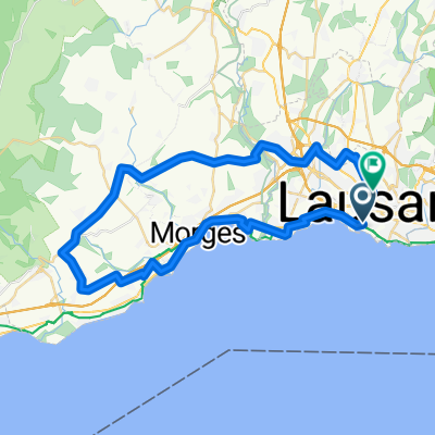
Mont Pélerin
A cycling route starting in Lausanne, Canton of Vaud, Switzerland.
Overview
About this route
- -:--
- Duration
- 39.6 km
- Distance
- 637 m
- Ascent
- 636 m
- Descent
- ---
- Avg. speed
- ---
- Max. altitude
Route quality
Waytypes & surfaces along the route
Waytypes
Road
17.8 km
(45 %)
Quiet road
12.3 km
(31 %)
Surfaces
Paved
22.2 km
(56 %)
Asphalt
20.2 km
(51 %)
Concrete
1.2 km
(3 %)
Continue with Bikemap
Use, edit, or download this cycling route
You would like to ride Mont Pélerin or customize it for your own trip? Here is what you can do with this Bikemap route:
Free features
- Save this route as favorite or in collections
- Copy & plan your own version of this route
- Sync your route with Garmin or Wahoo
Premium features
Free trial for 3 days, or one-time payment. More about Bikemap Premium.
- Navigate this route on iOS & Android
- Export a GPX / KML file of this route
- Create your custom printout (try it for free)
- Download this route for offline navigation
Discover more Premium features.
Get Bikemap PremiumFrom our community
Other popular routes starting in Lausanne
 Tour du Lac Leman
- Distance
- 174.9 km
- Ascent
- 860 m
- Descent
- 847 m
- Location
- Lausanne, Canton of Vaud, Switzerland
 Balade à vélo LT
- Distance
- 57.7 km
- Ascent
- 802 m
- Descent
- 802 m
- Location
- Lausanne, Canton of Vaud, Switzerland
 Tour de lac leman
- Distance
- 176.3 km
- Ascent
- 1,048 m
- Descent
- 1,039 m
- Location
- Lausanne, Canton of Vaud, Switzerland
 Lausanne-les paccots
- Distance
- 85.9 km
- Ascent
- 1,526 m
- Descent
- 1,550 m
- Location
- Lausanne, Canton of Vaud, Switzerland
 entraînement
- Distance
- 20 km
- Ascent
- 389 m
- Descent
- 412 m
- Location
- Lausanne, Canton of Vaud, Switzerland
 Lavigny - St-Saphorin-sur-Morges
- Distance
- 46 km
- Ascent
- 387 m
- Descent
- 246 m
- Location
- Lausanne, Canton of Vaud, Switzerland
 Lausanne - Mollie-Margot - Chexbres - Lausanne
- Distance
- 42 km
- Ascent
- 747 m
- Descent
- 749 m
- Location
- Lausanne, Canton of Vaud, Switzerland
 Mont Pélerin
- Distance
- 39.6 km
- Ascent
- 637 m
- Descent
- 636 m
- Location
- Lausanne, Canton of Vaud, Switzerland
Open it in the app