
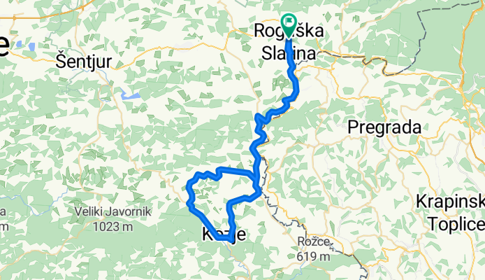
Maraton Rogaška Slatina
A cycling route starting in Rogaška Slatina, Občina Rogaška Slatina, Slovenia.
Overview
About this route
- -:--
- Duration
- 61 km
- Distance
- 409 m
- Ascent
- 409 m
- Descent
- ---
- Avg. speed
- ---
- Max. altitude

Route quality
Waytypes & surfaces along the route
Waytypes
Road
34.2 km
(56 %)
Quiet road
1.2 km
(2 %)
Surfaces
Paved
13.4 km
(22 %)
Asphalt
13.4 km
(22 %)
Undefined
47.6 km
(78 %)
Continue with Bikemap
Use, edit, or download this cycling route
You would like to ride Maraton Rogaška Slatina or customize it for your own trip? Here is what you can do with this Bikemap route:
Free features
- Save this route as favorite or in collections
- Copy & plan your own version of this route
- Sync your route with Garmin or Wahoo
Premium features
Free trial for 3 days, or one-time payment. More about Bikemap Premium.
- Navigate this route on iOS & Android
- Export a GPX / KML file of this route
- Create your custom printout (try it for free)
- Download this route for offline navigation
Discover more Premium features.
Get Bikemap PremiumFrom our community
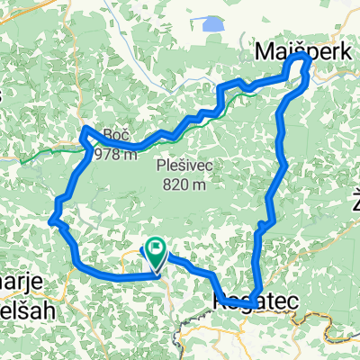
Other popular routes starting in Rogaška Slatina
 Rogaška Slatina Kolesarska pot 2
- Distance
- 10.2 km
- Ascent
- 158 m
- Descent
- 157 m
- Location
- Rogaška Slatina, Občina Rogaška Slatina, Slovenia
 Po poteh čokolade
- Distance
- 22.8 km
- Ascent
- 219 m
- Descent
- 170 m
- Location
- Rogaška Slatina, Občina Rogaška Slatina, Slovenia
 Hajnsko Boč via Vonarje
- Distance
- 43.7 km
- Ascent
- 670 m
- Descent
- 670 m
- Location
- Rogaška Slatina, Občina Rogaška Slatina, Slovenia
 Okrog Boča
- Distance
- 56 km
- Ascent
- 479 m
- Descent
- 472 m
- Location
- Rogaška Slatina, Občina Rogaška Slatina, Slovenia
 Hajnsko Ptuj
- Distance
- 96.5 km
- Ascent
- 550 m
- Descent
- 550 m
- Location
- Rogaška Slatina, Občina Rogaška Slatina, Slovenia
 Boč1
Boč1- Distance
- 29.3 km
- Ascent
- 932 m
- Descent
- 930 m
- Location
- Rogaška Slatina, Občina Rogaška Slatina, Slovenia
 rogaška-boč-makole-podboč-boč-rogaška
- Distance
- 41.2 km
- Ascent
- 1,007 m
- Descent
- 935 m
- Location
- Rogaška Slatina, Občina Rogaška Slatina, Slovenia
 Rogaška-Šmarje pri Jelšah-Rogaška
- Distance
- 54.2 km
- Ascent
- 413 m
- Descent
- 412 m
- Location
- Rogaška Slatina, Občina Rogaška Slatina, Slovenia
Open it in the app