Kopisk 50 km
A cycling route starting in Bialystok, Podlasie Voivodship, Poland.
Overview
About this route
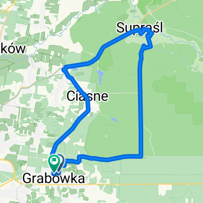
The route is slightly hilly and follows local paved roads. Behind Kulikówka, there is a sandy undulating road. Then a fast wide gravel track heading towards Kopisko. In Kopisko, we turn right behind the church and then the first left, following the road along the edge of the forest towards the cemetery. Behind the buildings, we enter the forest turning right at the cross. We continue straight, passing the junction to the fire road No. 13 and reach Letnik. A stretch of the Ełk road on the left shoulder. From Kołątaja street there is a bike path.
- -:--
- Duration
- 47.9 km
- Distance
- 253 m
- Ascent
- 248 m
- Descent
- ---
- Avg. speed
- 200 m
- Max. altitude
Route quality
Waytypes & surfaces along the route
Waytypes
Road
14.4 km
(30 %)
Quiet road
13.9 km
(29 %)
Surfaces
Paved
30.2 km
(63 %)
Unpaved
12 km
(25 %)
Asphalt
29.2 km
(61 %)
Gravel
5.3 km
(11 %)
Route highlights
Points of interest along the route
Point of interest after 8.7 km
Leśniczówka
Point of interest after 13.5 km
Kierunkowskaz - Kulikówka
Point of interest after 16.1 km
Pętla autobusowa - rondo
Point of interest after 20.7 km
Wjeżdzając do lasu mamy rozwidlenie. Prosto na Kopisk - w prawo tryba.
Point of interest after 28.3 km
Cmentarz
Point of interest after 29.6 km
Szeroka żwirówka - tryba
Point of interest after 30.7 km
Droga pożarowa nr 13
Continue with Bikemap
Use, edit, or download this cycling route
You would like to ride Kopisk 50 km or customize it for your own trip? Here is what you can do with this Bikemap route:
Free features
- Save this route as favorite or in collections
- Copy & plan your own version of this route
- Sync your route with Garmin or Wahoo
Premium features
Free trial for 3 days, or one-time payment. More about Bikemap Premium.
- Navigate this route on iOS & Android
- Export a GPX / KML file of this route
- Create your custom printout (try it for free)
- Download this route for offline navigation
Discover more Premium features.
Get Bikemap PremiumFrom our community
Other popular routes starting in Bialystok
 al Józefa Piłsudskiego, Białystok do al Józefa Piłsudskiego, Białystok
- Distance
- 44.9 km
- Ascent
- 424 m
- Descent
- 428 m
- Location
- Bialystok, Podlasie Voivodship, Poland
 Trasa A1
- Distance
- 18.2 km
- Ascent
- 104 m
- Descent
- 105 m
- Location
- Bialystok, Podlasie Voivodship, Poland
 Kopisk 50 km
- Distance
- 47.9 km
- Ascent
- 253 m
- Descent
- 248 m
- Location
- Bialystok, Podlasie Voivodship, Poland
 Bialystok-Krypno-Tykocin-Choroszcz-Bialystok
- Distance
- 65.9 km
- Ascent
- 295 m
- Descent
- 308 m
- Location
- Bialystok, Podlasie Voivodship, Poland
 Białystok - Michałowo - Zalew Siemianówka - Zabłudów - Białystok
- Distance
- 105.5 km
- Ascent
- 185 m
- Descent
- 185 m
- Location
- Bialystok, Podlasie Voivodship, Poland
 Czaplino ~23km.
- Distance
- 22.4 km
- Ascent
- 112 m
- Descent
- 112 m
- Location
- Bialystok, Podlasie Voivodship, Poland
 Trasa A4: Lasy miejskie: Zwierzyniecki i Turczyn
- Distance
- 17 km
- Ascent
- 65 m
- Descent
- 58 m
- Location
- Bialystok, Podlasie Voivodship, Poland
 Orzechowa, Grabówka do Orzechowa, Grabówka
- Distance
- 29.6 km
- Ascent
- 250 m
- Descent
- 249 m
- Location
- Bialystok, Podlasie Voivodship, Poland
Open it in the app


