

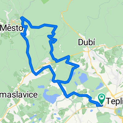
kolovýlet
A cycling route starting in Teplice, Ústecký kraj, Czechia.
Overview
About this route
- -:--
- Duration
- 169.5 km
- Distance
- 639 m
- Ascent
- 650 m
- Descent
- ---
- Avg. speed
- ---
- Max. altitude

Route photos


Route quality
Waytypes & surfaces along the route
Waytypes
Road
44.2 km
(26 %)
Quiet road
42.5 km
(25 %)
Surfaces
Paved
54.4 km
(32 %)
Unpaved
8 km
(5 %)
Asphalt
44.5 km
(26 %)
Paving stones
7.2 km
(4 %)
Continue with Bikemap
Use, edit, or download this cycling route
You would like to ride kolovýlet or customize it for your own trip? Here is what you can do with this Bikemap route:
Free features
- Save this route as favorite or in collections
- Copy & plan your own version of this route
- Split it into stages to create a multi-day tour
- Sync your route with Garmin or Wahoo
Premium features
Free trial for 3 days, or one-time payment. More about Bikemap Premium.
- Navigate this route on iOS & Android
- Export a GPX / KML file of this route
- Create your custom printout (try it for free)
- Download this route for offline navigation
Discover more Premium features.
Get Bikemap PremiumFrom our community
Other popular routes starting in Teplice
 Milča 5.8.15
- Distance
- 25.2 km
- Ascent
- 222 m
- Descent
- 222 m
- Location
- Teplice, Ústecký kraj, Czechia
 Z lázeňského centra s výhledy na Krušné hory i České středohoří k řece Bílině a zpět
- Distance
- 20 km
- Ascent
- 248 m
- Descent
- 248 m
- Location
- Teplice, Ústecký kraj, Czechia
 kolovýlet
- Distance
- 169.5 km
- Ascent
- 639 m
- Descent
- 650 m
- Location
- Teplice, Ústecký kraj, Czechia
 Na Gravelu do LT
- Distance
- 52.6 km
- Ascent
- 593 m
- Descent
- 670 m
- Location
- Teplice, Ústecký kraj, Czechia
 Hakysovo kotrmelec
- Distance
- 30.2 km
- Ascent
- 656 m
- Descent
- 640 m
- Location
- Teplice, Ústecký kraj, Czechia
 Teplice - Komáří vížka - Dlouhá louka - Teplice
- Distance
- 53.7 km
- Ascent
- 855 m
- Descent
- 855 m
- Location
- Teplice, Ústecký kraj, Czechia
 Milča 9.8.2015
- Distance
- 28.8 km
- Ascent
- 287 m
- Descent
- 278 m
- Location
- Teplice, Ústecký kraj, Czechia
 Na Džbán 2018
- Distance
- 151.5 km
- Ascent
- 1,167 m
- Descent
- 1,166 m
- Location
- Teplice, Ústecký kraj, Czechia
Open it in the app