

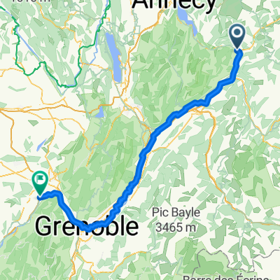
Annecy 4; Ugine
A cycling route starting in Ugine, Auvergne-Rhône-Alpes, France.
Overview
About this route
Col de la Forclaz 871; Saissies; Arpettaz
- -:--
- Duration
- 85.2 km
- Distance
- 2,411 m
- Ascent
- 2,396 m
- Descent
- ---
- Avg. speed
- ---
- Max. altitude
Route quality
Waytypes & surfaces along the route
Waytypes
Quiet road
37.5 km
(44 %)
Road
15.3 km
(18 %)
Surfaces
Paved
52 km
(61 %)
Unpaved
3.4 km
(4 %)
Asphalt
50.3 km
(59 %)
Paved (undefined)
1.7 km
(2 %)
Continue with Bikemap
Use, edit, or download this cycling route
You would like to ride Annecy 4; Ugine or customize it for your own trip? Here is what you can do with this Bikemap route:
Free features
- Save this route as favorite or in collections
- Copy & plan your own version of this route
- Split it into stages to create a multi-day tour
- Sync your route with Garmin or Wahoo
Premium features
Free trial for 3 days, or one-time payment. More about Bikemap Premium.
- Navigate this route on iOS & Android
- Export a GPX / KML file of this route
- Create your custom printout (try it for free)
- Download this route for offline navigation
Discover more Premium features.
Get Bikemap PremiumFrom our community
Other popular routes starting in Ugine
 Ugine - Saint-Quentin-sur-Isère
- Distance
- 128.4 km
- Ascent
- 324 m
- Descent
- 556 m
- Location
- Ugine, Auvergne-Rhône-Alpes, France
 Ugine - Aviernoz
- Distance
- 88.4 km
- Ascent
- 2,011 m
- Descent
- 1,651 m
- Location
- Ugine, Auvergne-Rhône-Alpes, France
 Cycling the Alps Signal de Bisanne (1930m)
- Distance
- 24.7 km
- Ascent
- 962 m
- Descent
- 1,231 m
- Location
- Ugine, Auvergne-Rhône-Alpes, France
 La Vilette - Col de Arpetaz 45 KM schwer
- Distance
- 42.5 km
- Ascent
- 1,691 m
- Descent
- 1,700 m
- Location
- Ugine, Auvergne-Rhône-Alpes, France
 Tour des aravis avec Mt Charvin curta
- Distance
- 76.1 km
- Ascent
- 1,683 m
- Descent
- 1,683 m
- Location
- Ugine, Auvergne-Rhône-Alpes, France
 Col Aperttaz via Ugine
- Distance
- 16.3 km
- Ascent
- 1,272 m
- Descent
- 114 m
- Location
- Ugine, Auvergne-Rhône-Alpes, France
 5 cols from Ugine
- Distance
- 79.5 km
- Ascent
- 1,893 m
- Descent
- 1,893 m
- Location
- Ugine, Auvergne-Rhône-Alpes, France
 Westalpen Etappe 01 - Ugine
- Distance
- 131.8 km
- Ascent
- 2,299 m
- Descent
- 2,290 m
- Location
- Ugine, Auvergne-Rhône-Alpes, France
Open it in the app