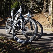
Erzgebirge 20180617
A cycling route starting in Marienberg, Saxony, Germany.
Overview
About this route
A beautiful ride through the Ore Mountains. Passing the Großrückerswalde airfield towards the Gelobtländer Bahnhof, but shortly before turning onto the Eisenstraße into the Preßnitztal. Then along the Preßnitztal cycle path to Schönbrun and to the Wolkenstein station - coffee break. Returning to Marienberg via Wolkenstein, Warmbad, and Hilmersdorf.
- -:--
- Duration
- 38 km
- Distance
- 507 m
- Ascent
- 507 m
- Descent
- ---
- Avg. speed
- ---
- Max. altitude
Route photos
Route quality
Waytypes & surfaces along the route
Waytypes
Road
11 km
(29 %)
Path
10.2 km
(27 %)
Surfaces
Paved
19 km
(50 %)
Unpaved
10.2 km
(27 %)
Asphalt
17.8 km
(47 %)
Loose gravel
7.2 km
(19 %)
Continue with Bikemap
Use, edit, or download this cycling route
You would like to ride Erzgebirge 20180617 or customize it for your own trip? Here is what you can do with this Bikemap route:
Free features
- Save this route as favorite or in collections
- Copy & plan your own version of this route
- Sync your route with Garmin or Wahoo
Premium features
Free trial for 3 days, or one-time payment. More about Bikemap Premium.
- Navigate this route on iOS & Android
- Export a GPX / KML file of this route
- Create your custom printout (try it for free)
- Download this route for offline navigation
Discover more Premium features.
Get Bikemap PremiumFrom our community
Other popular routes starting in Marienberg
- Lauta, Lauterbacher Knochen, Jüdenhain, Lauta Pferdegöpel
- Distance
- 10.9 km
- Ascent
- 147 m
- Descent
- 148 m
- Location
- Marienberg, Saxony, Germany
- Erzgebirge 20180701
- Distance
- 70.3 km
- Ascent
- 685 m
- Descent
- 685 m
- Location
- Marienberg, Saxony, Germany
- Erzgebirge 20180514, Test
- Distance
- 56.4 km
- Ascent
- 575 m
- Descent
- 575 m
- Location
- Marienberg, Saxony, Germany
- Erzgebirge 20180617
- Distance
- 38 km
- Ascent
- 507 m
- Descent
- 507 m
- Location
- Marienberg, Saxony, Germany
- Erzgebirge 20180519
- Distance
- 25.8 km
- Ascent
- 339 m
- Descent
- 339 m
- Location
- Marienberg, Saxony, Germany
- Mab-ATSV-Mab
- Distance
- 15.3 km
- Ascent
- 200 m
- Descent
- 200 m
- Location
- Marienberg, Saxony, Germany
- Gemütliche Route in Marienberg
- Distance
- 8.8 km
- Ascent
- 104 m
- Descent
- 104 m
- Location
- Marienberg, Saxony, Germany
- Gerade Fahrt in Marienberg
- Distance
- 18 km
- Ascent
- 358 m
- Descent
- 354 m
- Location
- Marienberg, Saxony, Germany
Open it in the app