

MTB-Tour: Mahlberturm und Bernsteinfels
A cycling route starting in Rheinstetten, Baden-Wurttemberg, Germany.
Overview
About this route
The Bernstein is a 693-meter-high mountain in the Northern Black Forest within the territory of the towns of Gaggenau and Bad Herrenalb. It forms part of the ridge that borders the front Murg valley on its eastern side. The summit of this mountain is a six-meter-high sandstone rock with a viewing platform of over 25 m². The panoramic view from Bernstein extends over the Murg valley, Hornisgrinde, Fremersberg near Baden-Baden, the Rhine plain, and on clear days as far as the Vosges and the Palatinate.
- -:--
- Duration
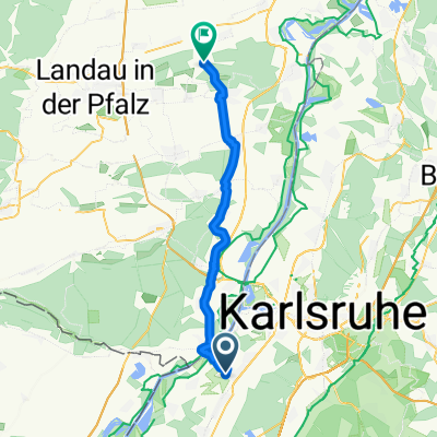
- 52.8 km
- Distance
- 830 m
- Ascent
- 811 m
- Descent
- ---
- Avg. speed
- ---
- Max. altitude

Continue with Bikemap
Use, edit, or download this cycling route
You would like to ride MTB-Tour: Mahlberturm und Bernsteinfels or customize it for your own trip? Here is what you can do with this Bikemap route:
Free features
- Save this route as favorite or in collections
- Copy & plan your own version of this route
- Sync your route with Garmin or Wahoo
Premium features
Free trial for 3 days, or one-time payment. More about Bikemap Premium.
- Navigate this route on iOS & Android
- Export a GPX / KML file of this route
- Create your custom printout (try it for free)
- Download this route for offline navigation
Discover more Premium features.
Get Bikemap PremiumFrom our community
Other popular routes starting in Rheinstetten
 KA-Flensburg
- Distance
- 1,114 km
- Ascent
- 595 m
- Descent
- 704 m
- Location
- Rheinstetten, Baden-Wurttemberg, Germany
 aus Rheinstetten in den Kraichgau mit Ortsdurchfahrten von Forchheim - KA Daxlanden - KA Knielingen - Eggenstein - Leopoldshafen - Staffort - Untergrombach - Ob
- Distance
- 112.2 km
- Ascent
- 420 m
- Descent
- 418 m
- Location
- Rheinstetten, Baden-Wurttemberg, Germany
 Radrunde Durmersheim - Rheinstetten
- Distance
- 19 km
- Ascent
- 19 m
- Descent
- 19 m
- Location
- Rheinstetten, Baden-Wurttemberg, Germany
 Rheinroute
- Distance
- 80.5 km
- Ascent
- 122 m
- Descent
- 123 m
- Location
- Rheinstetten, Baden-Wurttemberg, Germany
 RTF Concordia Forchheim (154 KM)
- Distance
- 153.2 km
- Ascent
- 3,630 m
- Descent
- 3,600 m
- Location
- Rheinstetten, Baden-Wurttemberg, Germany
 nach zeiskam
- Distance
- 37.3 km
- Ascent
- 146 m
- Descent
- 134 m
- Location
- Rheinstetten, Baden-Wurttemberg, Germany
 Schluttenbachrunde
- Distance
- 32.6 km
- Ascent
- 290 m
- Descent
- 286 m
- Location
- Rheinstetten, Baden-Wurttemberg, Germany
 Badische Eröffnungsfahrt - RTF des RSV Concordia 1920 Forchheim e.V. - 76 km Strecke
- Distance
- 76.5 km
- Ascent
- 325 m
- Descent
- 325 m
- Location
- Rheinstetten, Baden-Wurttemberg, Germany
Open it in the app