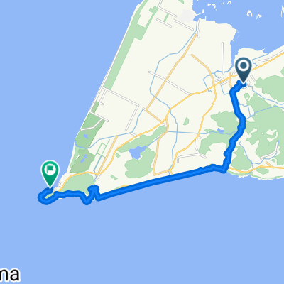
赤羽ロコステーション-伊良湖岬一周
A cycling route starting in Tahara, Aichi, Japan.
Overview
About this route
- -:--
- Duration
- 50.9 km
- Distance
- 215 m
- Ascent
- 214 m
- Descent
- ---
- Avg. speed
- ---
- Avg. speed
Route quality
Waytypes & surfaces along the route
Waytypes
Quiet road
19 km
(37 %)
Cycleway
13.9 km
(27 %)
Surfaces
Paved
16.2 km
(32 %)
Paved (undefined)
16 km
(31 %)
Asphalt
0.2 km
(<1 %)
Undefined
34.6 km
(68 %)
Continue with Bikemap
Use, edit, or download this cycling route
You would like to ride 赤羽ロコステーション-伊良湖岬一周 or customize it for your own trip? Here is what you can do with this Bikemap route:
Free features
- Save this route as favorite or in collections
- Copy & plan your own version of this route
- Sync your route with Garmin or Wahoo
Premium features
Free trial for 3 days, or one-time payment. More about Bikemap Premium.
- Navigate this route on iOS & Android
- Export a GPX / KML file of this route
- Create your custom printout (try it for free)
- Download this route for offline navigation
Discover more Premium features.
Get Bikemap PremiumFrom our community
Other popular routes starting in Tahara
- あそびンレンタ(市街地環状(西)コース)
- Distance
- 4 km
- Ascent
- 57 m
- Descent
- 57 m
- Location
- Tahara, Aichi, Japan
- のぼリンヒルクラ(蔵王山南口)
- Distance
- 3.5 km
- Ascent
- 254 m
- Descent
- 43 m
- Location
- Tahara, Aichi, Japan
- あそびンレンタ(サンテパルク)
- Distance
- 2.7 km
- Ascent
- 4 m
- Descent
- 4 m
- Location
- Tahara, Aichi, Japan
- のぼリンヒルクラ(滝頭観光道路東口)
- Distance
- 1 km
- Ascent
- 109 m
- Descent
- 26 m
- Location
- Tahara, Aichi, Japan
- のぼリンヒルクラ(滝頭観光道路西口)
- Distance
- 1.2 km
- Ascent
- 72 m
- Descent
- 0 m
- Location
- Tahara, Aichi, Japan
- Toshime to Utumi
- Distance
- 21 km
- Ascent
- 259 m
- Descent
- 268 m
- Location
- Tahara, Aichi, Japan
- length of Japan Tokaido Kakegawa city -Irago cape
- Distance
- 26.4 km
- Ascent
- 111 m
- Descent
- 141 m
- Location
- Tahara, Aichi, Japan
- あかばねロコステーション-伊良湖岬
- Distance
- 55.3 km
- Ascent
- 138 m
- Descent
- 137 m
- Location
- Tahara, Aichi, Japan