kurze Bergsprints
- 14.3 km
- 133 m
- 90 m
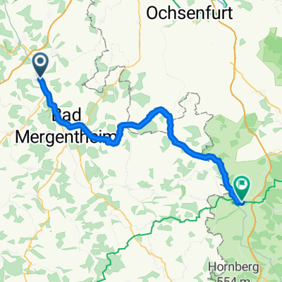
- Lauda-Königshofen, Baden-Wurttemberg, Germany
A cycling route starting in Lauda-Königshofen, Baden-Wurttemberg, Germany.
Overview
Small loop tour to warm up from Königshofen Beckstein via Bad Mergentheim. It can be done in half a day at a relaxed pace, although there are 350 meters of elevation to overcome. I plan to ride the tour next summer, then more about the route.
created this 7 years ago
Route quality
Quiet road
14 km
(47 %)
Track
7.1 km
(24 %)
Paved
22.3 km
(75 %)
Unpaved
0.3 km
(1 %)
Asphalt
19 km
(64 %)
Paved (undefined)
3.3 km
(11 %)
Continue with Bikemap
You would like to ride Rundtour Königshofen Beckstein or customize it for your own trip? Here is what you can do with this Bikemap route:
Free trial for 3 days, or one-time payment. More about Bikemap Premium.
Discover more Premium features.
Get Bikemap PremiumFrom our community
Open it in the app