

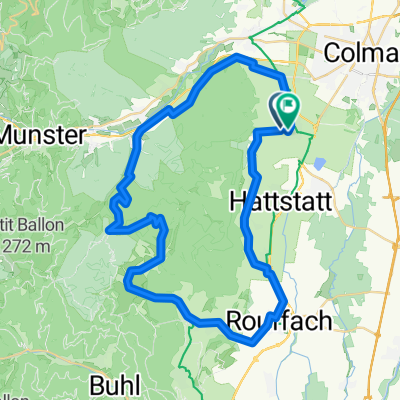
Vosge TDF2014 via Eguisheim
A cycling route starting in Eguisheim, Grand Est, France.
Overview
About this route
- -:--
- Duration
- 157.8 km
- Distance
- 2,525 m
- Ascent
- 2,487 m
- Descent
- ---
- Avg. speed
- ---
- Max. altitude
Route quality
Waytypes & surfaces along the route
Waytypes
Quiet road
42.6 km
(27 %)
Road
28.4 km
(18 %)
Surfaces
Paved
101 km
(64 %)
Unpaved
4.7 km
(3 %)
Asphalt
89.9 km
(57 %)
Paved (undefined)
11 km
(7 %)
Continue with Bikemap
Use, edit, or download this cycling route
You would like to ride Vosge TDF2014 via Eguisheim or customize it for your own trip? Here is what you can do with this Bikemap route:
Free features
- Save this route as favorite or in collections
- Copy & plan your own version of this route
- Split it into stages to create a multi-day tour
- Sync your route with Garmin or Wahoo
Premium features
Free trial for 3 days, or one-time payment. More about Bikemap Premium.
- Navigate this route on iOS & Android
- Export a GPX / KML file of this route
- Create your custom printout (try it for free)
- Download this route for offline navigation
Discover more Premium features.
Get Bikemap PremiumFrom our community
Other popular routes starting in Eguisheim
 dimanche avec les cocos
- Distance
- 41.6 km
- Ascent
- 1,290 m
- Descent
- 1,292 m
- Location
- Eguisheim, Grand Est, France
 Rundt om Col du Firstplan
- Distance
- 49.4 km
- Ascent
- 719 m
- Descent
- 719 m
- Location
- Eguisheim, Grand Est, France
 Vosge TDF2014 via Eguisheim
- Distance
- 157.8 km
- Ascent
- 2,525 m
- Descent
- 2,487 m
- Location
- Eguisheim, Grand Est, France
 Colmar - Les Vic
- Distance
- 49.2 km
- Ascent
- 813 m
- Descent
- 493 m
- Location
- Eguisheim, Grand Est, France
 FR. Vosges Col Amic Grand Ballon
- Distance
- 94.7 km
- Ascent
- 1,378 m
- Descent
- 1,378 m
- Location
- Eguisheim, Grand Est, France
 Eguisheim, rund um Le Stauffen
- Distance
- 37.8 km
- Ascent
- 780 m
- Descent
- 782 m
- Location
- Eguisheim, Grand Est, France
 Eguisheim, Repos du Chasseur, Turckheim, Trois Epis, Turckheim
- Distance
- 39 km
- Ascent
- 846 m
- Descent
- 847 m
- Location
- Eguisheim, Grand Est, France
 Route in Egisheim
- Distance
- 50.6 km
- Ascent
- 1,053 m
- Descent
- 1,057 m
- Location
- Eguisheim, Grand Est, France
Open it in the app