

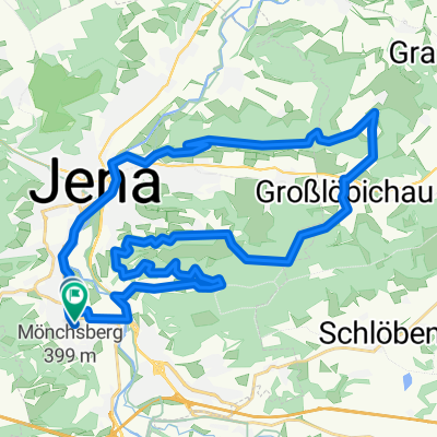
Etappe4
A cycling route starting in Jena, Thuringia, Germany.
Overview
About this route
Etappe 4
- -:--
- Duration
- 100 km
- Distance
- 861 m
- Ascent
- 522 m
- Descent
- ---
- Avg. speed
- ---
- Max. altitude

Route quality
Waytypes & surfaces along the route
Waytypes
Road
20.5 km
(21 %)
Busy road
18.2 km
(18 %)
Surfaces
Paved
56.8 km
(57 %)
Unpaved
10.1 km
(10 %)
Asphalt
52.7 km
(53 %)
Gravel
7.8 km
(8 %)
Continue with Bikemap
Use, edit, or download this cycling route
You would like to ride Etappe4 or customize it for your own trip? Here is what you can do with this Bikemap route:
Free features
- Save this route as favorite or in collections
- Copy & plan your own version of this route
- Split it into stages to create a multi-day tour
- Sync your route with Garmin or Wahoo
Premium features
Free trial for 3 days, or one-time payment. More about Bikemap Premium.
- Navigate this route on iOS & Android
- Export a GPX / KML file of this route
- Create your custom printout (try it for free)
- Download this route for offline navigation
Discover more Premium features.
Get Bikemap PremiumFrom our community
Other popular routes starting in Jena
 Hohenwarte-Runde
- Distance
- 171.3 km
- Ascent
- 2,292 m
- Descent
- 2,253 m
- Location
- Jena, Thuringia, Germany
 Jena - Leuchtenburg/St. Ganloff
- Distance
- 91.1 km
- Ascent
- 585 m
- Descent
- 585 m
- Location
- Jena, Thuringia, Germany
 Feierabendrunde TPA
- Distance
- 38.5 km
- Ascent
- 443 m
- Descent
- 437 m
- Location
- Jena, Thuringia, Germany
 Forst/Ammerbach
- Distance
- 14.2 km
- Ascent
- 291 m
- Descent
- 291 m
- Location
- Jena, Thuringia, Germany
 : Halbtagestour mit Kindern
- Distance
- 29.6 km
- Ascent
- 185 m
- Descent
- 201 m
- Location
- Jena, Thuringia, Germany
 2. Rad n Roll MTB Marathon
- Distance
- 28.6 km
- Ascent
- 607 m
- Descent
- 494 m
- Location
- Jena, Thuringia, Germany
 Klein aber Fein
- Distance
- 32.9 km
- Ascent
- 335 m
- Descent
- 293 m
- Location
- Jena, Thuringia, Germany
 Trainingsrunde
- Distance
- 34.9 km
- Ascent
- 559 m
- Descent
- 558 m
- Location
- Jena, Thuringia, Germany
Open it in the app