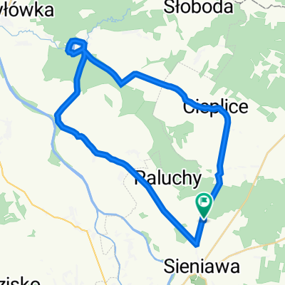
- 44.8 km
- 113 m
- 148 m
- Sieniawa, Subcarpathian Voivodeship, Poland
Sieniawa-Rudnik n/Sanem
A cycling route starting in Sieniawa, Subcarpathian Voivodeship, Poland.
Overview
About this route
- -:--
- Duration
- 216.4 km
- Distance
- 349 m
- Ascent
- 362 m
- Descent
- ---
- Avg. speed
- ---
- Max. altitude
created this 15 years ago
Route highlights
Points of interest along the route
Point of interest after 0.7 km
Pałac w Sieniawie. Rozpoczynamy od zwiedzania tego kompleksu pałacowego.
Photo after 36.6 km
Cerkiew w stylu bizańtyńskim z 1904 roku, kościół z XVIII wieku i synagoga.
Photo after 77.5 km
Szumy nad Tanwią.
Accommodation after 85.6 km
Rezerwat Borowe Młyny - polana na której można się rozbić (chyba). Ewentualny nocleg.
Accommodation after 154.8 km
Ciekawe miejsce. Ciekawy układ lokacji miejscowości. Możliwy nocleg (165 kilometr).
Continue with Bikemap
Use, edit, or download this cycling route
You would like to ride Sieniawa-Rudnik n/Sanem or customize it for your own trip? Here is what you can do with this Bikemap route:
Free features
- Save this route as favorite or in collections
- Copy & plan your own version of this route
- Split it into stages to create a multi-day tour
- Sync your route with Garmin or Wahoo
Premium features
Free trial for 3 days, or one-time payment. More about Bikemap Premium.
- Navigate this route on iOS & Android
- Export a GPX / KML file of this route
- Create your custom printout (try it for free)
- Download this route for offline navigation
Discover more Premium features.
Get Bikemap PremiumFrom our community
Other popular routes starting in Sieniawa
- Wylewa- Wiązownica - Radawa- Wylewa
- awaryjna v3
- 466.8 km
- 518 m
- 526 m
- Sieniawa, Subcarpathian Voivodeship, Poland
- Wylewa do Wylewa
- 33.4 km
- 131 m
- 171 m
- Sieniawa, Subcarpathian Voivodeship, Poland
- Pierwsza niedzielna trasa
- 20.1 km
- 61 m
- 61 m
- Sieniawa, Subcarpathian Voivodeship, Poland
- Wylewa- Cieplice- Kolonia Polska- Ożanna- Tarnawiec- Leżajsk- Wylewa
- 55.4 km
- 276 m
- 280 m
- Sieniawa, Subcarpathian Voivodeship, Poland
- Wylewa- Leżajsk- Ożanna -Wylewa
- 47.9 km
- 182 m
- 184 m
- Sieniawa, Subcarpathian Voivodeship, Poland
- Wylewa do Strażnica kolejowa Tryńcza
- 27.6 km
- 24 m
- 26 m
- Sieniawa, Subcarpathian Voivodeship, Poland
- Perły Podk-6n
- 68.6 km
- 184 m
- 155 m
- Sieniawa, Subcarpathian Voivodeship, Poland
Open it in the app


