Rocca Sinibalda-Colle di Tora-Pozzaglia-Orvinio
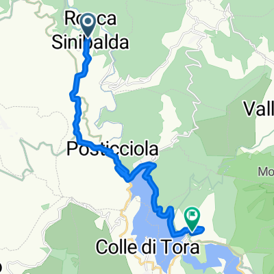
A cycling route starting in Rocca Sinibalda, Lazio, Italy.
Overview
About this route
The 'Cammino di San Benedetto' continues.
From Rocca Sinibalda, you reach Posticciola. Then you follow the western side of the lake to get to Colle di Tora. We arrive at Castel di Tora and follow the eastern side of the lake for a stretch, before crossing back over to the other shore and following the southwest side.
Now we face a challenging climb to Pietraforte and Nontorio in the valley to reach Pozzaglia Sabina.
Now we head towards Orvinio, taking a detour to pass by the ancient and abandoned Abbey of Santa Maria del Piano. We also ride along a stretch of the old medieval road and, finally, one last ramp brings us to Orvinio.
- -:--
- Duration
- 42.1 km
- Distance
- 703 m
- Ascent
- 460 m
- Descent
- ---
- Avg. speed
- ---
- Max. altitude
Route quality
Waytypes & surfaces along the route
Waytypes
Quiet road
12.2 km
(29 %)
Road
10.5 km
(25 %)
Surfaces
Paved
22.7 km
(54 %)
Unpaved
4.6 km
(11 %)
Asphalt
20.6 km
(49 %)
Gravel
4.6 km
(11 %)
Continue with Bikemap
Use, edit, or download this cycling route
You would like to ride Rocca Sinibalda-Colle di Tora-Pozzaglia-Orvinio or customize it for your own trip? Here is what you can do with this Bikemap route:
Free features
- Save this route as favorite or in collections
- Copy & plan your own version of this route
- Sync your route with Garmin or Wahoo
Premium features
Free trial for 3 days, or one-time payment. More about Bikemap Premium.
- Navigate this route on iOS & Android
- Export a GPX / KML file of this route
- Create your custom printout (try it for free)
- Download this route for offline navigation
Discover more Premium features.
Get Bikemap PremiumFrom our community
Other popular routes starting in Rocca Sinibalda
- Giro dei 2 laghi
- Distance
- 105.3 km
- Ascent
- 1,807 m
- Descent
- 1,804 m
- Location
- Rocca Sinibalda, Lazio, Italy
- Rocca Sinibalda-Teramo
- Distance
- 133.6 km
- Ascent
- 1,453 m
- Descent
- 1,737 m
- Location
- Rocca Sinibalda, Lazio, Italy
- RI-Rocca Sin-Laghi-Ri stessa strada
- Distance
- 125.9 km
- Ascent
- 1,440 m
- Descent
- 1,440 m
- Location
- Rocca Sinibalda, Lazio, Italy
- Il Giro dei 2 Laghi
- Distance
- 119.3 km
- Ascent
- 1,872 m
- Descent
- 1,872 m
- Location
- Rocca Sinibalda, Lazio, Italy
- 15-RoccaSinibalda-Roma
- Distance
- 87.7 km
- Ascent
- 339 m
- Descent
- 883 m
- Location
- Rocca Sinibalda, Lazio, Italy
- Rocca Sinibalda-Colle di Tora-Pozzaglia-Orvinio
- Distance
- 42.1 km
- Ascent
- 703 m
- Descent
- 460 m
- Location
- Rocca Sinibalda, Lazio, Italy
- SANBENEDETTO 07 ROCCA SINIBALDA-CASTEL DI TORA
- Distance
- 13.8 km
- Ascent
- 366 m
- Descent
- 338 m
- Location
- Rocca Sinibalda, Lazio, Italy
- Rocca Sinibalda-Antrodoco-Leonessa-Terminillo-Rocca Sinibalda
- Distance
- 135.8 km
- Ascent
- 1,816 m
- Descent
- 1,842 m
- Location
- Rocca Sinibalda, Lazio, Italy
Open it in the app