

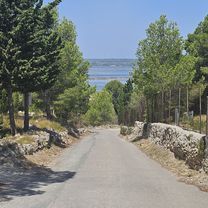
narbonne round
A cycling route starting in Leucate, Occitanie, France.
Overview
About this route
- -:--
- Duration
- 111.4 km
- Distance
- 431 m
- Ascent
- 435 m
- Descent
- ---
- Avg. speed
- ---
- Max. altitude

Route quality
Waytypes & surfaces along the route
Waytypes
Road
37.9 km
(34 %)
Track
21.2 km
(19 %)
Surfaces
Paved
29 km
(26 %)
Unpaved
29 km
(26 %)
Gravel
26.7 km
(24 %)
Asphalt
24.5 km
(22 %)
Continue with Bikemap
Use, edit, or download this cycling route
You would like to ride narbonne round or customize it for your own trip? Here is what you can do with this Bikemap route:
Free features
- Save this route as favorite or in collections
- Copy & plan your own version of this route
- Split it into stages to create a multi-day tour
- Sync your route with Garmin or Wahoo
Premium features
Free trial for 3 days, or one-time payment. More about Bikemap Premium.
- Navigate this route on iOS & Android
- Export a GPX / KML file of this route
- Create your custom printout (try it for free)
- Download this route for offline navigation
Discover more Premium features.
Get Bikemap PremiumFrom our community
Other popular routes starting in Leucate
 tour d etang
- Distance
- 79.7 km
- Ascent
- 408 m
- Descent
- 408 m
- Location
- Leucate, Occitanie, France
 "La Philippe Bécade" . Sortie à travers les Corbières le 11 10 2009.
- Distance
- 95.3 km
- Ascent
- 1,392 m
- Descent
- 1,298 m
- Location
- Leucate, Occitanie, France
 narbonne round
- Distance
- 111.4 km
- Ascent
- 431 m
- Descent
- 435 m
- Location
- Leucate, Occitanie, France
 De Leucate à Le Barcarès
- Distance
- 20.4 km
- Ascent
- 58 m
- Descent
- 72 m
- Location
- Leucate, Occitanie, France
 Corbiere 100
- Distance
- 101.1 km
- Ascent
- 680 m
- Descent
- 680 m
- Location
- Leucate, Occitanie, France
 Leucate Cave Cooperative nach Place Claude Debussy
- Distance
- 14.3 km
- Ascent
- 21 m
- Descent
- 100 m
- Location
- Leucate, Occitanie, France
 La Palme
- Distance
- 31.3 km
- Ascent
- 163 m
- Descent
- 168 m
- Location
- Leucate, Occitanie, France
 D327 nach D327
- Distance
- 47.5 km
- Ascent
- 559 m
- Descent
- 610 m
- Location
- Leucate, Occitanie, France
Open it in the app