

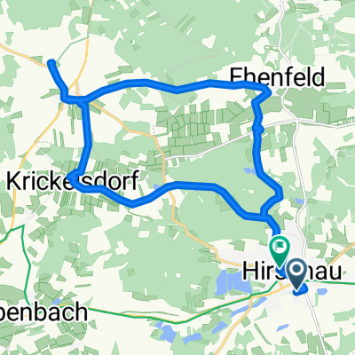
Hirschau - Gebenbach - Weiherhammer - Oberwildenau - Hirschau
A cycling route starting in Hirschau, Bavaria, Germany.
Overview
About this route
Hirschau - Gebenbach - Weiherhammer - Oberwildenau - Hirschau
- -:--
- Duration
- 59.4 km
- Distance
- 329 m
- Ascent
- 331 m
- Descent
- ---
- Avg. speed
- ---
- Max. altitude
Route quality
Waytypes & surfaces along the route
Waytypes
Quiet road
24.3 km
(41 %)
Track
17.8 km
(30 %)
Surfaces
Paved
45.7 km
(77 %)
Unpaved
12.5 km
(21 %)
Asphalt
45.1 km
(76 %)
Gravel
8.3 km
(14 %)
Continue with Bikemap
Use, edit, or download this cycling route
You would like to ride Hirschau - Gebenbach - Weiherhammer - Oberwildenau - Hirschau or customize it for your own trip? Here is what you can do with this Bikemap route:
Free features
- Save this route as favorite or in collections
- Copy & plan your own version of this route
- Sync your route with Garmin or Wahoo
Premium features
Free trial for 3 days, or one-time payment. More about Bikemap Premium.
- Navigate this route on iOS & Android
- Export a GPX / KML file of this route
- Create your custom printout (try it for free)
- Download this route for offline navigation
Discover more Premium features.
Get Bikemap PremiumFrom our community
Other popular routes starting in Hirschau
 Wanderung von Hirschau nach Seugast und Kleinschönbrunn
- Distance
- 12 km
- Ascent
- 249 m
- Descent
- 213 m
- Location
- Hirschau, Bavaria, Germany
 freundschaftsmarathon abschnitt 2
- Distance
- 10.4 km
- Ascent
- 70 m
- Descent
- 76 m
- Location
- Hirschau, Bavaria, Germany
 1. Teil von Ehenfeld Freihung Vilseck mit Auenpark nach Kreuzberg
- Distance
- 30 km
- Ascent
- 241 m
- Descent
- 247 m
- Location
- Hirschau, Bavaria, Germany
 Kaolinrevier
- Distance
- 28.5 km
- Ascent
- 472 m
- Descent
- 475 m
- Location
- Hirschau, Bavaria, Germany
 Runde in den Südwesten mit Bergen
- Distance
- 121.7 km
- Ascent
- 1,182 m
- Descent
- 1,123 m
- Location
- Hirschau, Bavaria, Germany
 piRADen Weihnachtstour
- Distance
- 29.8 km
- Ascent
- 529 m
- Descent
- 526 m
- Location
- Hirschau, Bavaria, Germany
 Hirschau - Vilstalquelle - Linde - Hirschau
- Distance
- 19.4 km
- Ascent
- 357 m
- Descent
- 335 m
- Location
- Hirschau, Bavaria, Germany
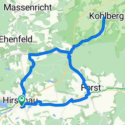 Hi -Kindlas - Kohlberg - Hi
- Distance
- 22.7 km
- Ascent
- 409 m
- Descent
- 409 m
- Location
- Hirschau, Bavaria, Germany
Open it in the app