

Deutschland_Bayern_Franken
D_Bayern_Hirschbach-Eschenbach-Vorra_RR-(Urwaldwegschleife-Koppeschleife-RR)_23km-540hm
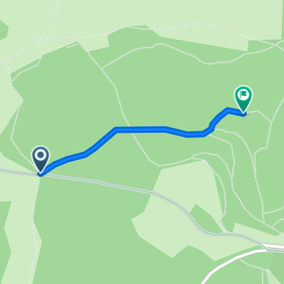
A cycling route starting in Hirschbach, Bavaria, Germany.
Overview
About this route
- -:--
- Duration
- 23 km
- Distance
- 649 m
- Ascent
- 641 m
- Descent
- ---
- Avg. speed
- ---
- Max. altitude

Part of
Deutschland_Bayern_Franken
1 stage
Continue with Bikemap
Use, edit, or download this cycling route
You would like to ride D_Bayern_Hirschbach-Eschenbach-Vorra_RR-(Urwaldwegschleife-Koppeschleife-RR)_23km-540hm or customize it for your own trip? Here is what you can do with this Bikemap route:
Free features
- Save this route as favorite or in collections
- Copy & plan your own version of this route
- Sync your route with Garmin or Wahoo
Premium features
Free trial for 3 days, or one-time payment. More about Bikemap Premium.
- Navigate this route on iOS & Android
- Export a GPX / KML file of this route
- Create your custom printout (try it for free)
- Download this route for offline navigation
Discover more Premium features.
Get Bikemap PremiumFrom our community
Other popular routes starting in Hirschbach
 hoehlenwegsteilgeuebt20km600hm
- Distance
- 19.9 km
- Ascent
- 714 m
- Descent
- 714 m
- Location
- Hirschbach, Bavaria, Germany
 dog walk & talk (FB): D - Hersbruck-Hirschbach-Hegendorf-Schmidtstadt
- Distance
- 12.5 km
- Ascent
- 400 m
- Descent
- 400 m
- Location
- Hirschbach, Bavaria, Germany
 Anton II
- Distance
- 77.8 km
- Ascent
- 1,028 m
- Descent
- 1,098 m
- Location
- Hirschbach, Bavaria, Germany
 dog walk & talk (FB): D - Hersbruck-Hirschbach-Neuhaus
- Distance
- 24.5 km
- Ascent
- 648 m
- Descent
- 653 m
- Location
- Hirschbach, Bavaria, Germany
 Alfeld
- Distance
- 42.2 km
- Ascent
- 530 m
- Descent
- 488 m
- Location
- Hirschbach, Bavaria, Germany
 Schwarzbrennerei
- Distance
- 0.6 km
- Ascent
- 53 m
- Descent
- 0 m
- Location
- Hirschbach, Bavaria, Germany
 Eschenbach - Hirschbachtal - Pegnitztalrunde
- Distance
- 78.8 km
- Ascent
- 565 m
- Descent
- 524 m
- Location
- Hirschbach, Bavaria, Germany
 Hirschbacher Dorfplatz 1 nach Am Adlersberg 13, Hirschbach
- Distance
- 26.2 km
- Ascent
- 657 m
- Descent
- 651 m
- Location
- Hirschbach, Bavaria, Germany
Open it in the app