
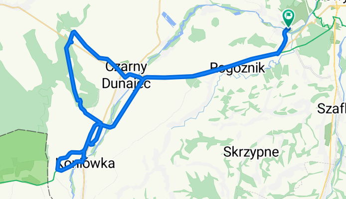
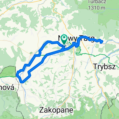
Podhale dz.I
A cycling route starting in Ludźmierz, Lesser Poland Voivodeship, Poland.
Overview
About this route
- -:--
- Duration
- 45.9 km
- Distance
- 188 m
- Ascent
- 186 m
- Descent
- ---
- Avg. speed
- ---
- Max. altitude
Route quality
Waytypes & surfaces along the route
Waytypes
Cycleway
20.2 km
(44 %)
Track
10.5 km
(23 %)
Surfaces
Paved
31.2 km
(68 %)
Unpaved
9.7 km
(21 %)
Asphalt
31.2 km
(68 %)
Ground
8.2 km
(18 %)
Continue with Bikemap
Use, edit, or download this cycling route
You would like to ride Podhale dz.I or customize it for your own trip? Here is what you can do with this Bikemap route:
Free features
- Save this route as favorite or in collections
- Copy & plan your own version of this route
- Sync your route with Garmin or Wahoo
Premium features
Free trial for 3 days, or one-time payment. More about Bikemap Premium.
- Navigate this route on iOS & Android
- Export a GPX / KML file of this route
- Create your custom printout (try it for free)
- Download this route for offline navigation
Discover more Premium features.
Get Bikemap PremiumFrom our community
Other popular routes starting in Ludźmierz
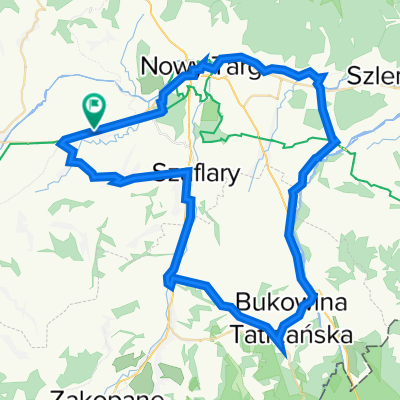 Osiedle Za Torem 13–15a, Rogoźnik do Osiedle Za Torem 12B, Rogoźnik
- Distance
- 69.7 km
- Ascent
- 837 m
- Descent
- 839 m
- Location
- Ludźmierz, Lesser Poland Voivodeship, Poland
 Nowy Targ - Dolina Białej Wody
- Distance
- 72.8 km
- Ascent
- 671 m
- Descent
- 674 m
- Location
- Ludźmierz, Lesser Poland Voivodeship, Poland
 podhale
- Distance
- 65.1 km
- Ascent
- 830 m
- Descent
- 829 m
- Location
- Ludźmierz, Lesser Poland Voivodeship, Poland
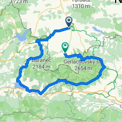
 Pętla wokół Tatr
- Distance
- 290 km
- Ascent
- 1,572 m
- Descent
- 1,566 m
- Location
- Ludźmierz, Lesser Poland Voivodeship, Poland
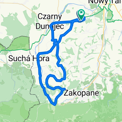
 Lengthy bike tour through Zakopane
- Distance
- 200.7 km
- Ascent
- 1,814 m
- Descent
- 1,602 m
- Location
- Ludźmierz, Lesser Poland Voivodeship, Poland
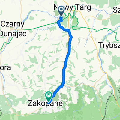 Sądowa, Nowy Targ to T Kościuszki, Zakopane
- Distance
- 24.2 km
- Ascent
- 306 m
- Descent
- 71 m
- Location
- Ludźmierz, Lesser Poland Voivodeship, Poland
 Ludźmierz - Chochołów
- Distance
- 74.4 km
- Ascent
- 400 m
- Descent
- 400 m
- Location
- Ludźmierz, Lesser Poland Voivodeship, Poland
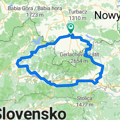
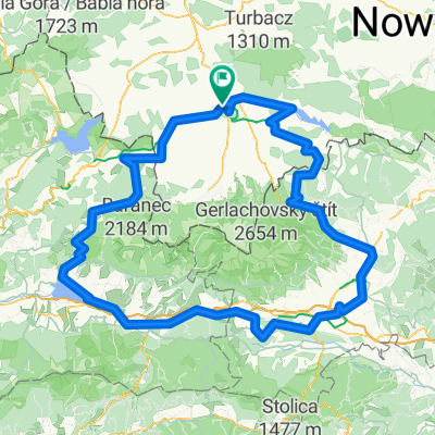 Wokół Tatr
- Distance
- 302.4 km
- Ascent
- 4,345 m
- Descent
- 4,348 m
- Location
- Ludźmierz, Lesser Poland Voivodeship, Poland
Open it in the app