

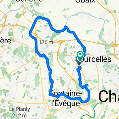
24 KM
A cycling route starting in Courcelles, Wallonia, Belgium.
Overview
About this route
- -:--
- Duration
- 24.2 km
- Distance
- 83 m
- Ascent
- 83 m
- Descent
- ---
- Avg. speed
- ---
- Max. altitude
Continue with Bikemap
Use, edit, or download this cycling route
You would like to ride 24 KM or customize it for your own trip? Here is what you can do with this Bikemap route:
Free features
- Save this route as favorite or in collections
- Copy & plan your own version of this route
- Sync your route with Garmin or Wahoo
Premium features
Free trial for 3 days, or one-time payment. More about Bikemap Premium.
- Navigate this route on iOS & Android
- Export a GPX / KML file of this route
- Create your custom printout (try it for free)
- Download this route for offline navigation
Discover more Premium features.
Get Bikemap PremiumFrom our community
Other popular routes starting in Courcelles
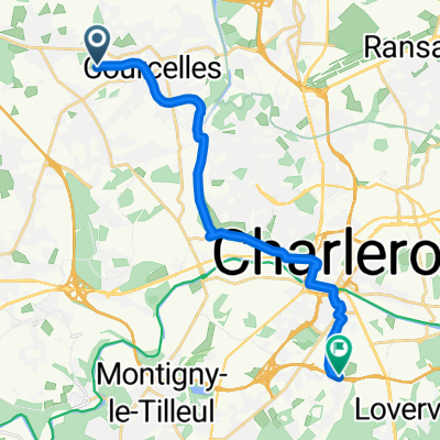 From Courcelles to Charleroi
- Distance
- 15.2 km
- Ascent
- 65 m
- Descent
- 102 m
- Location
- Courcelles, Wallonia, Belgium
 Balade 19 oct 2025 - 36 Km
- Distance
- 36.1 km
- Ascent
- 265 m
- Descent
- 265 m
- Location
- Courcelles, Wallonia, Belgium
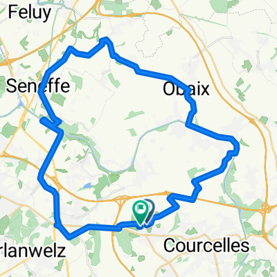
 63 Km Courcelles - Luttre -Seneffe - Thieu - La Louvière - Morlanwelz - Trazegnies
- Distance
- 63.9 km
- Ascent
- 185 m
- Descent
- 185 m
- Location
- Courcelles, Wallonia, Belgium
 24 KM
24 KM- Distance
- 24.2 km
- Ascent
- 83 m
- Descent
- 83 m
- Location
- Courcelles, Wallonia, Belgium
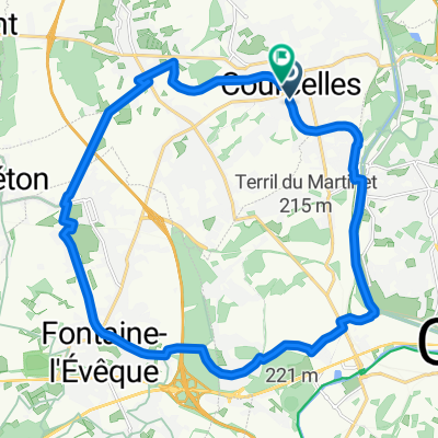
 Tragopoco
- Distance
- 23.8 km
- Ascent
- 108 m
- Descent
- 108 m
- Location
- Courcelles, Wallonia, Belgium
 De Rue sous le Bois 55–73, Charleroi à Rue sous le Bois 65, Charleroi
- Distance
- 21.7 km
- Ascent
- 247 m
- Descent
- 309 m
- Location
- Courcelles, Wallonia, Belgium
 Balade aout 2025
- Distance
- 37.9 km
- Ascent
- 251 m
- Descent
- 254 m
- Location
- Courcelles, Wallonia, Belgium
 Balade Ravel tour
- Distance
- 21.9 km
- Ascent
- 134 m
- Descent
- 135 m
- Location
- Courcelles, Wallonia, Belgium
Open it in the app