

Cheile Turzii
A cycling route starting in Sănduleşti, Cluj County, Romania.
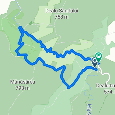
Overview
About this route
The route I propose, which I have also done, involves traversing the interior of the gorge and returning via one of the ridges. I chose the right slope, meaning the one on the left side when you ascend upstream through the gorge.
Interior of the gorge
Marking: Red dot
Duration: 1-1½ hours
Difficulty: easy
The starting point is near the Cheile Turzii Cabin from where you descend towards the watercourse, following it upstream to the exit of the gorge, from where you return via one of the ridges. In terms of difficulty, the route is relatively easy, only the ridges can be a bit more demanding at the beginning. Otherwise, along the gorge, there are slightly dangerous sections that require increased attention, but nothing too difficult.
Within the gorge, above the water of the Hășdate valley that crosses Cheile Turzii, there are 4 bridges. Starting from the Cheile Turzii Cabin upstream, until the first bridge (also called "Cave Bridge"), the tourist trail follows the right bank of the Hășdate Valley; between bridge I and bridge II the left bank; between bridge II (also called "Middle of the Gorge") and bridge III the right bank; between bridge III (called "Washed Den") and bridge IV (called "Gorge Gate") the left bank; and after bridge IV (until exiting Cheile Turzii towards the village of Petreștii de Jos) the right bank.
Right slope
Marking: Red dot
Duration: 2-2½ hours
Difficulty: medium
When you finish traversing the gorge, you will have the Hășdate River on your left, which you will need to cross to climb to the right slope. For this, you can take off your shoes, step on stones, or advance along the river to the campground where there is a bridge.
At the edge of the forest that comes very close to the river, a post with signposts shows us the way to the ridge crest, a path that continues through the forest on a steep trail (this is the most demanding part of the route).
On the stones along the path, the red dot marking appears here and there painted. In some places, the bushes are denser and long pants are recommended. Be careful not to miss the viewpoint, the view is indescribable. After reaching the ridge, the route becomes quite simple and the scenery will delight your eyes.
- -:--
- Duration
- 6.8 km
- Distance
- 535 m
- Ascent
- 533 m
- Descent
- ---
- Avg. speed
- ---
- Max. altitude

Route photos

Continue with Bikemap
Use, edit, or download this cycling route
You would like to ride Cheile Turzii or customize it for your own trip? Here is what you can do with this Bikemap route:
Free features
- Save this route as favorite or in collections
- Copy & plan your own version of this route
- Sync your route with Garmin or Wahoo
Premium features
Free trial for 3 days, or one-time payment. More about Bikemap Premium.
- Navigate this route on iOS & Android
- Export a GPX / KML file of this route
- Create your custom printout (try it for free)
- Download this route for offline navigation
Discover more Premium features.
Get Bikemap PremiumFrom our community
Other popular routes starting in Sănduleşti
 Jokai E Szind-Torocko nehez
- Distance
- 83.5 km
- Ascent
- 2,513 m
- Descent
- 2,437 m
- Location
- Sănduleşti, Cluj County, Romania
 Cheile Turzii
- Distance
- 6.8 km
- Ascent
- 535 m
- Descent
- 533 m
- Location
- Sănduleşti, Cluj County, Romania
 Turda Gorges
- Distance
- 5 km
- Ascent
- 430 m
- Descent
- 421 m
- Location
- Sănduleşti, Cluj County, Romania
 Sandulesti - Cheia - Turda - Sandulesti
- Distance
- 18.8 km
- Ascent
- 263 m
- Descent
- 264 m
- Location
- Sănduleşti, Cluj County, Romania
 Easy ride
- Distance
- 2.2 km
- Ascent
- 58 m
- Descent
- 148 m
- Location
- Sănduleşti, Cluj County, Romania
 Jókai Mór KETT2017-Szind-Torockó_H1
- Distance
- 30.5 km
- Ascent
- 713 m
- Descent
- 635 m
- Location
- Sănduleşti, Cluj County, Romania
 De DJ103I à DJ103I
- Distance
- 95.8 km
- Ascent
- 7,660 m
- Descent
- 7,664 m
- Location
- Sănduleşti, Cluj County, Romania
 Tura in jurul Cheilor Turzii 2016
- Distance
- 53.9 km
- Ascent
- 785 m
- Descent
- 788 m
- Location
- Sănduleşti, Cluj County, Romania
Open it in the app