

''Vélocio - Mt Ventoux" - Gorges de la Nesque - 16 Juin 18 - Y.P.
A cycling route starting in Carpentras, Provence-Alpes-Côte d'Azur Region, France.
Overview
About this route
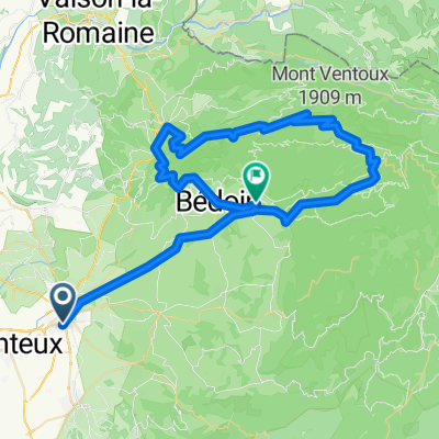
<p><strong>Carpentras ©</strong> ( <strong><em>start „Vélocio“</em></strong>) - cycle route „Via Vénaissia“ - Aubignan – CV – Vacqueyras – Gigondas – Sablet – Séguret - Roaix – <strong>Vaison la Romaine ©</strong> ( <strong>BPF 84</strong> ) - <strong>Entrechaux ©</strong> ( <strong><em>refreshment stop</em></strong> ) – <strong>Malaucène</strong> – <strong><em>Châlet Lyotard</em></strong> - <strong>Mt Ventoux © </strong>( <strong>1909 m</strong> – <strong>BPF 84</strong> ) – <strong><em>Col des Tempêtes</em></strong> - <strong><em>„Les Hermittants“ ©</em></strong> ( <strong><em>refreshment stop</em></strong> ) - <strong><em>Chalet Reynard</em></strong> – St Estève – <strong>Ste Colombe</strong> - Flassan – La Gabelle – <strong><em>elevation 910 m</em></strong> – La Loge – Monieux – <strong><em>Gorges de la Nesque</em></strong> – Villes sur Auzon – <strong>Mormoiron</strong> - <strong><em>elevation 360 m</em></strong> – St Pierre de Vassols – Modène – Caromb – Serres – <strong>Carpentras ©</strong> ( <strong><em>finish „Vélocio“</em></strong>).</p>
Translated, show original (French)- -:--
- Duration
- 183 km
- Distance
- 2,563 m
- Ascent
- 2,564 m
- Descent
- ---
- Avg. speed
- ---
- Max. altitude

Route quality
Waytypes & surfaces along the route
Waytypes
Road
80.5 km
(44 %)
Quiet road
20.1 km
(11 %)
Surfaces
Paved
133.6 km
(73 %)
Asphalt
133.6 km
(73 %)
Undefined
49.4 km
(27 %)
Continue with Bikemap
Use, edit, or download this cycling route
You would like to ride ''Vélocio - Mt Ventoux" - Gorges de la Nesque - 16 Juin 18 - Y.P. or customize it for your own trip? Here is what you can do with this Bikemap route:
Free features
- Save this route as favorite or in collections
- Copy & plan your own version of this route
- Split it into stages to create a multi-day tour
- Sync your route with Garmin or Wahoo
Premium features
Free trial for 3 days, or one-time payment. More about Bikemap Premium.
- Navigate this route on iOS & Android
- Export a GPX / KML file of this route
- Create your custom printout (try it for free)
- Download this route for offline navigation
Discover more Premium features.
Get Bikemap PremiumFrom our community
Other popular routes starting in Carpentras
 carpentras-maulacene-mou ventoux-bèdoin-carpentras
- Distance
- 79.4 km
- Ascent
- 1,859 m
- Descent
- 1,877 m
- Location
- Carpentras, Provence-Alpes-Côte d'Azur Region, France
 2. Radetappe Luberon - Camargue
- Distance
- 43.4 km
- Ascent
- 724 m
- Descent
- 512 m
- Location
- Carpentras, Provence-Alpes-Côte d'Azur Region, France
 carpentras-cavaillon
- Distance
- 81.1 km
- Ascent
- 144 m
- Descent
- 163 m
- Location
- Carpentras, Provence-Alpes-Côte d'Azur Region, France
 Mt. Ventoux - Carpentras - Bedoin
- Distance
- 72.9 km
- Ascent
- 1,832 m
- Descent
- 1,832 m
- Location
- Carpentras, Provence-Alpes-Côte d'Azur Region, France
 10. Tag Carpentras - Avignon
- Distance
- 93.5 km
- Ascent
- 718 m
- Descent
- 797 m
- Location
- Carpentras, Provence-Alpes-Côte d'Azur Region, France
 Carpentras-Gordes-..
- Distance
- 70.8 km
- Ascent
- 664 m
- Descent
- 665 m
- Location
- Carpentras, Provence-Alpes-Côte d'Azur Region, France
 1. Etappe Carpentras-Ventoux-Bedoin
- Distance
- 71.8 km
- Ascent
- 2,012 m
- Descent
- 1,682 m
- Location
- Carpentras, Provence-Alpes-Côte d'Azur Region, France
 Carpentras - Beames de Venise - Bedoin
- Distance
- 45.6 km
- Ascent
- 337 m
- Descent
- 334 m
- Location
- Carpentras, Provence-Alpes-Côte d'Azur Region, France
Open it in the app