

san Antonio de prado
A cycling route starting in Itagüí, Antioquia, Colombia.
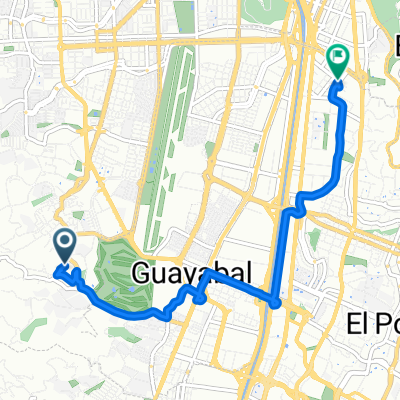
Overview
About this route
- 46 min
- Duration
- 7.5 km
- Distance
- 443 m
- Ascent
- 75 m
- Descent
- 9.8 km/h
- Avg. speed
- ---
- Max. altitude

Route photos

Continue with Bikemap
Use, edit, or download this cycling route
You would like to ride san Antonio de prado or customize it for your own trip? Here is what you can do with this Bikemap route:
Free features
- Save this route as favorite or in collections
- Copy & plan your own version of this route
- Sync your route with Garmin or Wahoo
Premium features
Free trial for 3 days, or one-time payment. More about Bikemap Premium.
- Navigate this route on iOS & Android
- Export a GPX / KML file of this route
- Create your custom printout (try it for free)
- Download this route for offline navigation
Discover more Premium features.
Get Bikemap PremiumFrom our community
Other popular routes starting in Itagüí
 Paseo Rapido
- Distance
- 49.7 km
- Ascent
- 544 m
- Descent
- 556 m
- Location
- Itagüí, Antioquia, Colombia
 la virgen de Guadalupe
- Distance
- 40.8 km
- Ascent
- 446 m
- Descent
- 447 m
- Location
- Itagüí, Antioquia, Colombia
 De Carrera 79 1-11, Medellín a Calle 2 79-129, Medellín
- Distance
- 13.8 km
- Ascent
- 70 m
- Descent
- 66 m
- Location
- Itagüí, Antioquia, Colombia
 Casa Eco
- Distance
- 7.5 km
- Ascent
- 89 m
- Descent
- 133 m
- Location
- Itagüí, Antioquia, Colombia
 De Carrera 79 1-11, Medellín a Carrera 81 1SUR-81, Medellín
- Distance
- 14.4 km
- Ascent
- 101 m
- Descent
- 77 m
- Location
- Itagüí, Antioquia, Colombia
 medellin- parque el salado
- Distance
- 9 km
- Ascent
- 332 m
- Descent
- 9 m
- Location
- Itagüí, Antioquia, Colombia
 Carrera 73 98, Medellín to Transversal 32D 74d-53, Medellín
- Distance
- 16.4 km
- Ascent
- 242 m
- Descent
- 258 m
- Location
- Itagüí, Antioquia, Colombia
 SiCleada 27-03-2024
- Distance
- 35.8 km
- Ascent
- 421 m
- Descent
- 417 m
- Location
- Itagüí, Antioquia, Colombia
Open it in the app