

13.8. Camping kleguer - Morlaix - Plougasnou
A cycling route starting in Saint-Pol-de-Léon, Brittany Region, France.
Overview
About this route
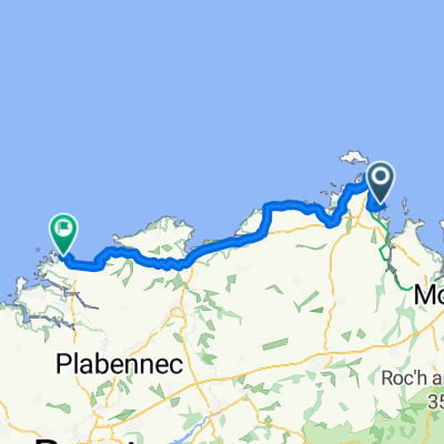
Camping municipal de la Mer plougasnou
- -:--
- Duration
- 40.3 km
- Distance
- 353 m
- Ascent
- 348 m
- Descent
- ---
- Avg. speed
- ---
- Max. altitude
Route quality
Waytypes & surfaces along the route
Waytypes
Road
15.6 km
(39 %)
Busy road
12.6 km
(31 %)
Surfaces
Paved
24.8 km
(62 %)
Unpaved
1.8 km
(4 %)
Asphalt
24.8 km
(62 %)
Ground
1.8 km
(4 %)
Undefined
13.7 km
(34 %)
Continue with Bikemap
Use, edit, or download this cycling route
You would like to ride 13.8. Camping kleguer - Morlaix - Plougasnou or customize it for your own trip? Here is what you can do with this Bikemap route:
Free features
- Save this route as favorite or in collections
- Copy & plan your own version of this route
- Sync your route with Garmin or Wahoo
Premium features
Free trial for 3 days, or one-time payment. More about Bikemap Premium.
- Navigate this route on iOS & Android
- Export a GPX / KML file of this route
- Create your custom printout (try it for free)
- Download this route for offline navigation
Discover more Premium features.
Get Bikemap PremiumFrom our community
Other popular routes starting in Saint-Pol-de-Léon
 13.8. Camping kleguer - Morlaix - Plougasnou
- Distance
- 40.3 km
- Ascent
- 353 m
- Descent
- 348 m
- Location
- Saint-Pol-de-Léon, Brittany Region, France
 Rue du Colombier 1, Saint-Pol-de-Léon to Rue du Colombier 1, Saint-Pol-de-Léon
- Distance
- 0 km
- Ascent
- 0 m
- Descent
- 0 m
- Location
- Saint-Pol-de-Léon, Brittany Region, France
 Saint-Pol-de-Léon to Place Emile Souvestre 15, Morlaix
- Distance
- 23.2 km
- Ascent
- 510 m
- Descent
- 532 m
- Location
- Saint-Pol-de-Léon, Brittany Region, France
 Saint-Pol-de-Léon - Plougoulm
- Distance
- 6.4 km
- Ascent
- 26 m
- Descent
- 56 m
- Location
- Saint-Pol-de-Léon, Brittany Region, France
 Saint Paul - Roscoff - Santec - Plougoulm par la Littorale
- Distance
- 22.5 km
- Ascent
- 76 m
- Descent
- 103 m
- Location
- Saint-Pol-de-Léon, Brittany Region, France
 Promenade lente
- Distance
- 9.7 km
- Ascent
- 86 m
- Descent
- 102 m
- Location
- Saint-Pol-de-Léon, Brittany Region, France
 5-й день
- Distance
- 63.2 km
- Ascent
- 238 m
- Descent
- 232 m
- Location
- Saint-Pol-de-Léon, Brittany Region, France
 petite balade 1er jour
- Distance
- 9.2 km
- Ascent
- 62 m
- Descent
- 62 m
- Location
- Saint-Pol-de-Léon, Brittany Region, France
Open it in the app