

M41 - Pamir Highway (via Bartang)
M41 - Day 01 - Kalaikhum - Vanj Valley
A cycling route starting in Qalaikhumb, Gorno-Badakhshan, Tajikistan.
Overview
About this route
altitude start: 1260m
altitude end: 1542m
- -:--
- Duration
- 85.1 km
- Distance
- 651 m
- Ascent
- 373 m
- Descent
- ---
- Avg. speed
- ---
- Max. altitude

Part of
M41 - Pamir Highway (via Bartang)
10 stages
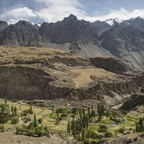
Route photos


Route quality
Waytypes & surfaces along the route
Surfaces
Unpaved
85.1 km
(100 %)
Gravel
85.1 km
(100 %)
Continue with Bikemap
Use, edit, or download this cycling route
You would like to ride M41 - Day 01 - Kalaikhum - Vanj Valley or customize it for your own trip? Here is what you can do with this Bikemap route:
Free features
- Save this route as favorite or in collections
- Copy & plan your own version of this route
- Split it into stages to create a multi-day tour
- Sync your route with Garmin or Wahoo
Premium features
Free trial for 3 days, or one-time payment. More about Bikemap Premium.
- Navigate this route on iOS & Android
- Export a GPX / KML file of this route
- Create your custom printout (try it for free)
- Download this route for offline navigation
Discover more Premium features.
Get Bikemap PremiumFrom our community
Other popular routes starting in Qalaikhumb
 R: Kalaikhum - Tyrchit
- Distance
- 239.2 km
- Ascent
- 1,411 m
- Descent
- 624 m
- Location
- Qalaikhumb, Gorno-Badakhshan, Tajikistan
 Pamir
Pamir- Distance
- 686 km
- Ascent
- 4,288 m
- Descent
- 1,629 m
- Location
- Qalaikhumb, Gorno-Badakhshan, Tajikistan
 Kalaikhum-Khorog
- Distance
- 237.6 km
- Ascent
- 1,280 m
- Descent
- 453 m
- Location
- Qalaikhumb, Gorno-Badakhshan, Tajikistan
 Pamir Route B
- Distance
- 1,097.3 km
- Ascent
- 5,038 m
- Descent
- 5,319 m
- Location
- Qalaikhumb, Gorno-Badakhshan, Tajikistan
 Day 30 Tadzhikistan
- Distance
- 6.9 km
- Ascent
- 325 m
- Descent
- 126 m
- Location
- Qalaikhumb, Gorno-Badakhshan, Tajikistan
 el Kalaikhum al Murghab
- Distance
- 622.6 km
- Ascent
- 4,951 m
- Descent
- 2,593 m
- Location
- Qalaikhumb, Gorno-Badakhshan, Tajikistan
 2016Pamir31-1_08-21
- Distance
- 19.3 km
- Ascent
- 401 m
- Descent
- 442 m
- Location
- Qalaikhumb, Gorno-Badakhshan, Tajikistan
 Tajikistan 4
- Distance
- 288.8 km
- Ascent
- 3,014 m
- Descent
- 3,465 m
- Location
- Qalaikhumb, Gorno-Badakhshan, Tajikistan
Open it in the app