

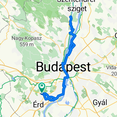
Nagytétény - Csepel - Szigetszentmiklós - Nagytétény
A cycling route starting in Diósd, Pest County, Hungary.
Overview
About this route
- -:--
- Duration
- 42.6 km
- Distance
- 36 m
- Ascent
- 34 m
- Descent
- ---
- Avg. speed
- ---
- Max. altitude
Route quality
Waytypes & surfaces along the route
Waytypes
Cycleway
19.2 km
(45 %)
Quiet road
8.5 km
(20 %)
Surfaces
Paved
32.4 km
(76 %)
Unpaved
1.7 km
(4 %)
Asphalt
32 km
(75 %)
Gravel
1.3 km
(3 %)
Continue with Bikemap
Use, edit, or download this cycling route
You would like to ride Nagytétény - Csepel - Szigetszentmiklós - Nagytétény or customize it for your own trip? Here is what you can do with this Bikemap route:
Free features
- Save this route as favorite or in collections
- Copy & plan your own version of this route
- Sync your route with Garmin or Wahoo
Premium features
Free trial for 3 days, or one-time payment. More about Bikemap Premium.
- Navigate this route on iOS & Android
- Export a GPX / KML file of this route
- Create your custom printout (try it for free)
- Download this route for offline navigation
Discover more Premium features.
Get Bikemap PremiumFrom our community
Other popular routes starting in Diósd
 Diósd-Szentendre
- Distance
- 98.6 km
- Ascent
- 587 m
- Descent
- 589 m
- Location
- Diósd, Pest County, Hungary
 Ligetszépe-Tűzoltó
- Distance
- 21.6 km
- Ascent
- 47 m
- Descent
- 52 m
- Location
- Diósd, Pest County, Hungary
 Nagytétény - Csepel - Szigetszentmiklós - Nagytétény
- Distance
- 42.6 km
- Ascent
- 36 m
- Descent
- 34 m
- Location
- Diósd, Pest County, Hungary
 Diósd - Nagytétény - Érd - Diósd
- Distance
- 21.1 km
- Ascent
- 93 m
- Descent
- 93 m
- Location
- Diósd, Pest County, Hungary
 BuVe1
BuVe1- Distance
- 58 km
- Ascent
- 555 m
- Descent
- 637 m
- Location
- Diósd, Pest County, Hungary
 Nagytétény - Szigetszentmiklós - Csepel - Nagytétény
- Distance
- 39.6 km
- Ascent
- 34 m
- Descent
- 34 m
- Location
- Diósd, Pest County, Hungary
 Érd-B.örs_Tbálint
- Distance
- 43.1 km
- Ascent
- 219 m
- Descent
- 219 m
- Location
- Diósd, Pest County, Hungary
 Vadvirág utca, Diósd - Szt István utca, Törökbálint
- Distance
- 4.8 km
- Ascent
- 85 m
- Descent
- 119 m
- Location
- Diósd, Pest County, Hungary
Open it in the app