

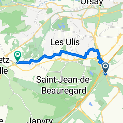
Bures - Douvres - par Breteuil
A cycling route starting in Les Ulis, Île-de-France Region, France.
Overview
About this route
Camping in Breteuil
http://www.campinglesbergesdeliton.com/plan-d-acc%C3%A8s/
Camping in Deauville/Trouville
- -:--
- Duration
- 269.9 km
- Distance
- 372 m
- Ascent
- 498 m
- Descent
- ---
- Avg. speed
- ---
- Max. altitude

Route quality
Waytypes & surfaces along the route
Waytypes
Road
81 km
(30 %)
Quiet road
37.8 km
(14 %)
Surfaces
Paved
91.8 km
(34 %)
Unpaved
8.1 km
(3 %)
Asphalt
89.1 km
(33 %)
Loose gravel
5.4 km
(2 %)
Continue with Bikemap
Use, edit, or download this cycling route
You would like to ride Bures - Douvres - par Breteuil or customize it for your own trip? Here is what you can do with this Bikemap route:
Free features
- Save this route as favorite or in collections
- Copy & plan your own version of this route
- Split it into stages to create a multi-day tour
- Sync your route with Garmin or Wahoo
Premium features
Free trial for 3 days, or one-time payment. More about Bikemap Premium.
- Navigate this route on iOS & Android
- Export a GPX / KML file of this route
- Create your custom printout (try it for free)
- Download this route for offline navigation
Discover more Premium features.
Get Bikemap PremiumFrom our community
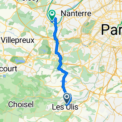
Other popular routes starting in Les Ulis
 30k Paris
- Distance
- 29.6 km
- Ascent
- 249 m
- Descent
- 404 m
- Location
- Les Ulis, Île-de-France Region, France
 Bures - Douvres - par Breteuil
- Distance
- 269.9 km
- Ascent
- 372 m
- Descent
- 498 m
- Location
- Les Ulis, Île-de-France Region, France
 Itinéraire à partir de Rue des Bergères 1, Les Ulis
- Distance
- 24.1 km
- Ascent
- 8 m
- Descent
- 104 m
- Location
- Les Ulis, Île-de-France Region, France
 Дом-Живерни
- Distance
- 85.8 km
- Ascent
- 710 m
- Descent
- 855 m
- Location
- Les Ulis, Île-de-France Region, France
 Bures-sur-Yvette Orléans
- Distance
- 130.9 km
- Ascent
- 307 m
- Descent
- 360 m
- Location
- Les Ulis, Île-de-France Region, France
 Chemin de Fretay, Villejust à Rue Thuillère, Gometz-le-Châtel
- Distance
- 6.6 km
- Ascent
- 20 m
- Descent
- 17 m
- Location
- Les Ulis, Île-de-France Region, France
 Maison -Travail
- Distance
- 29.5 km
- Ascent
- 240 m
- Descent
- 360 m
- Location
- Les Ulis, Île-de-France Region, France
 De Chemin de Montjay 29, Bures-sur-Yvette à Rue Carnot 58, Sainte-Geneviève-des-Bois
- Distance
- 16.8 km
- Ascent
- 104 m
- Descent
- 117 m
- Location
- Les Ulis, Île-de-France Region, France
Open it in the app