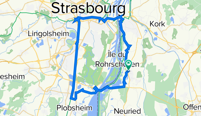


pont Pflimlin 24/08/2025
- 62.9 km
- 111 m
- 110 m
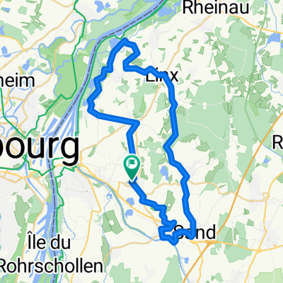
- Willstätt, Baden-Wurttemberg, Germany
A cycling route starting in Willstätt, Baden-Wurttemberg, Germany.
Overview
Lovely circuit that also runs along the beautiful Canal de la Rhóne au Rhin. At the start and finish point, you can park your car in the REWE and Lidl parking lot.
created this 7 years ago


Route quality
Path
12.5 km
(32 %)
Cycleway
8.6 km
(22 %)
Paved
34.4 km
(88 %)
Unpaved
2.7 km
(7 %)
Asphalt
31.6 km
(81 %)
Concrete
1.6 km
(4 %)
Continue with Bikemap
You would like to ride Canal Runde - Über Eschau bis Strasbourg or customize it for your own trip? Here is what you can do with this Bikemap route:
Free trial for 3 days, or one-time payment. More about Bikemap Premium.
Discover more Premium features.
Get Bikemap PremiumFrom our community
Open it in the app