

Silvretta-Hochalpenstraße und Arlbergpaß RR
A cycling route starting in Schruns, Vorarlberg, Austria.
Overview
About this route
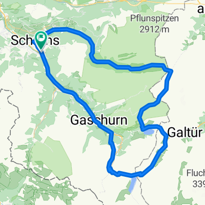
Schöne RR-Tour mit zwei Top-Pässen in gigantischer Landschaft; Start in Schruns (Bhf, 690m)); hinein ins Montafon und hinauf zum Silvretta-Stausee (2030m); hinab durchs Paznauntal nach Pians (960m), wo man über die alte Arlbergstraße den Rückweg einleitet. Hinauf nach St.Anton auf den Arlberg-Paß (1793m) und wieder hinab nach Bludenz; dann wieder ins Montafon nach Schruns
- -:--
- Duration
- 138.8 km
- Distance
- 2,371 m
- Ascent
- 2,371 m
- Descent
- ---
- Avg. speed
- ---
- Max. altitude

Continue with Bikemap
Use, edit, or download this cycling route
You would like to ride Silvretta-Hochalpenstraße und Arlbergpaß RR or customize it for your own trip? Here is what you can do with this Bikemap route:
Free features
- Save this route as favorite or in collections
- Copy & plan your own version of this route
- Split it into stages to create a multi-day tour
- Sync your route with Garmin or Wahoo
Premium features
Free trial for 3 days, or one-time payment. More about Bikemap Premium.
- Navigate this route on iOS & Android
- Export a GPX / KML file of this route
- Create your custom printout (try it for free)
- Download this route for offline navigation
Discover more Premium features.
Get Bikemap PremiumFrom our community
Other popular routes starting in Schruns
 Tschagguns - Latschau - Vadans - Schruns
- Distance
- 24.6 km
- Ascent
- 984 m
- Descent
- 986 m
- Location
- Schruns, Vorarlberg, Austria
 schruns partenen heilbronner hütte silbertal schruns
- Distance
- 75.7 km
- Ascent
- 2,289 m
- Descent
- 2,290 m
- Location
- Schruns, Vorarlberg, Austria
 M3 - extrem Montafon Mountainbike Marathon // Teilstrecken nur am Renntag befahrbar!
- Distance
- 134.5 km
- Ascent
- 4,344 m
- Descent
- 4,342 m
- Location
- Schruns, Vorarlberg, Austria
 Schruns-Saarbrücker hütte
- Distance
- 69.1 km
- Ascent
- 1,871 m
- Descent
- 1,875 m
- Location
- Schruns, Vorarlberg, Austria
 MeHC 2023
- Distance
- 9.9 km
- Ascent
- 1,174 m
- Descent
- 6 m
- Location
- Schruns, Vorarlberg, Austria
 Vandans - Schweizer Tor - Lindauer Hütte
- Distance
- 35.4 km
- Ascent
- 1,680 m
- Descent
- 1,687 m
- Location
- Schruns, Vorarlberg, Austria
 Silvretta-Hochalpenstraße und Arlbergpaß RR
- Distance
- 138.8 km
- Ascent
- 2,371 m
- Descent
- 2,371 m
- Location
- Schruns, Vorarlberg, Austria
 Rund um den Itonskopf Tour
- Distance
- 24.4 km
- Ascent
- 1,319 m
- Descent
- 916 m
- Location
- Schruns, Vorarlberg, Austria
Open it in the app