

München (City-Parktour 3)
A cycling route starting in Unterföhring, Bavaria, Germany.
Overview
About this route
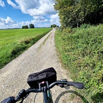
Munich is dotted in the northeast by many small park landscapes that can be connected, thus offering an (for those who like) extraordinary tour. Starting at Aumeister in Freimann, the tour goes through Johanneskirchen, Englschalking, Denning, and Daglfing. From there, it heads east through the riding facilities of Riem to the Buga grounds. The return via Trudering and Berg am Laim leads us to Haidhausen. Through smaller backyard green spaces with sports fields, one reaches the Isar, along which one returns to the starting point.
- -:--
- Duration
- 34.9 km
- Distance
- 54 m
- Ascent
- 54 m
- Descent
- ---
- Avg. speed
- ---
- Max. altitude

Route highlights
Points of interest along the route
\"")
Photo after 6.8 km
Denninger Anger Ost (Geologiegarten)
\"")
Photo after 17 km
Aussichtshügel Riem (Blickrichtung Südwest)
\"")
Photo after 17.2 km
Aussichtshügel Riem (Blickrichtung Nordwest)
\"")
Photo after 19.6 km
Wegende (Riemer Park)
\"")
Photo after 28.7 km
Friedensengel
Continue with Bikemap
Use, edit, or download this cycling route
You would like to ride München (City-Parktour 3) or customize it for your own trip? Here is what you can do with this Bikemap route:
Free features
- Save this route as favorite or in collections
- Copy & plan your own version of this route
- Sync your route with Garmin or Wahoo
Premium features
Free trial for 3 days, or one-time payment. More about Bikemap Premium.
- Navigate this route on iOS & Android
- Export a GPX / KML file of this route
- Create your custom printout (try it for free)
- Download this route for offline navigation
Discover more Premium features.
Get Bikemap PremiumFrom our community
Other popular routes starting in Unterföhring
 Tag 1: Von München nach Schongau
- Distance
- 98.5 km
- Ascent
- 744 m
- Descent
- 599 m
- Location
- Unterföhring, Bavaria, Germany
 Isarradweg
- Distance
- 19.6 km
- Ascent
- 63 m
- Descent
- 113 m
- Location
- Unterföhring, Bavaria, Germany
 Freimann - Grünwald - Freimann
- Distance
- 46.7 km
- Ascent
- 146 m
- Descent
- 145 m
- Location
- Unterföhring, Bavaria, Germany
 Pasing Schule
- Distance
- 13.9 km
- Ascent
- 92 m
- Descent
- 63 m
- Location
- Unterföhring, Bavaria, Germany
 Unterföhring - Aschheim - Kirchheim - Fischweiher - Ismaning - Garching - Freimann - Unterföhring
- Distance
- 33.8 km
- Ascent
- 35 m
- Descent
- 37 m
- Location
- Unterföhring, Bavaria, Germany
 21.04.
- Distance
- 56.1 km
- Ascent
- 79 m
- Descent
- 82 m
- Location
- Unterföhring, Bavaria, Germany
 Teststrecke nach Starnberg
- Distance
- 33.1 km
- Ascent
- 167 m
- Descent
- 77 m
- Location
- Unterföhring, Bavaria, Germany
 Von Johanneskirchen nach Moosach
- Distance
- 11.6 km
- Ascent
- 29 m
- Descent
- 38 m
- Location
- Unterföhring, Bavaria, Germany
Open it in the app