Soca trail
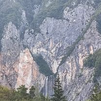
A cycling route starting in Bovec, Občina Bovec, Slovenia.
Overview
About this route
Links abbiegen in Kobarid
Rechts abbiegen an der Brücke
- -:--
- Duration
- 44.3 km
- Distance
- 499 m
- Ascent
- 497 m
- Descent
- ---
- Avg. speed
- ---
- Avg. speed
Continue with Bikemap
Use, edit, or download this cycling route
You would like to ride Soca trail or customize it for your own trip? Here is what you can do with this Bikemap route:
Free features
- Save this route as favorite or in collections
- Copy & plan your own version of this route
- Sync your route with Garmin or Wahoo
Premium features
Free trial for 3 days, or one-time payment. More about Bikemap Premium.
- Navigate this route on iOS & Android
- Export a GPX / KML file of this route
- Create your custom printout (try it for free)
- Download this route for offline navigation
Discover more Premium features.
Get Bikemap PremiumFrom our community
Other popular routes starting in Bovec
- Heimweg
- Distance
- 24.2 km
- Ascent
- 546 m
- Descent
- 750 m
- Location
- Bovec, Občina Bovec, Slovenia
- Bovec
- Distance
- 114.7 km
- Ascent
- 3,091 m
- Descent
- 3,089 m
- Location
- Bovec, Občina Bovec, Slovenia
- Bovec zahodna pot
- Distance
- 18.3 km
- Ascent
- 338 m
- Descent
- 334 m
- Location
- Bovec, Občina Bovec, Slovenia
- Ziua a doua
- Distance
- 125.8 km
- Ascent
- 4,185 m
- Descent
- 4,170 m
- Location
- Bovec, Občina Bovec, Slovenia
- Von Bovec bis Tolmein
- Distance
- 38.6 km
- Ascent
- 768 m
- Descent
- 1,047 m
- Location
- Bovec, Občina Bovec, Slovenia
- Ziua a doua scurt
- Distance
- 83.7 km
- Ascent
- 2,525 m
- Descent
- 2,511 m
- Location
- Bovec, Občina Bovec, Slovenia
- Julijska tura: Na Mangart
- Distance
- 11.6 km
- Ascent
- 1,029 m
- Descent
- 146 m
- Location
- Bovec, Občina Bovec, Slovenia
- Route to Gostilna Pri Stefanu
- Distance
- 43.9 km
- Ascent
- 910 m
- Descent
- 1,196 m
- Location
- Bovec, Občina Bovec, Slovenia
Open it in the app