

bonelli park
A cycling route starting in San Dimas, California, United States.
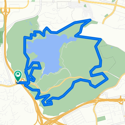
Overview
About this route
- 2 h 5 min
- Duration
- 23.9 km
- Distance
- 437 m
- Ascent
- 423 m
- Descent
- 11.5 km/h
- Avg. speed
- ---
- Max. altitude

Route photos


Route quality
Waytypes & surfaces along the route
Waytypes
Cycleway
8.6 km
(36 %)
Path
6.9 km
(29 %)
Surfaces
Paved
2.1 km
(9 %)
Asphalt
2.1 km
(9 %)
Undefined
21.7 km
(91 %)
Continue with Bikemap
Use, edit, or download this cycling route
You would like to ride bonelli park or customize it for your own trip? Here is what you can do with this Bikemap route:
Free features
- Save this route as favorite or in collections
- Copy & plan your own version of this route
- Sync your route with Garmin or Wahoo
Premium features
Free trial for 3 days, or one-time payment. More about Bikemap Premium.
- Navigate this route on iOS & Android
- Export a GPX / KML file of this route
- Create your custom printout (try it for free)
- Download this route for offline navigation
Discover more Premium features.
Get Bikemap PremiumFrom our community
Other popular routes starting in San Dimas
 Easy ride in San Dimas
- Distance
- 14.4 km
- Ascent
- 176 m
- Descent
- 144 m
- Location
- San Dimas, California, United States
 Route to 451 E Rowland St, Covina
- Distance
- 9.2 km
- Ascent
- 87 m
- Descent
- 218 m
- Location
- San Dimas, California, United States

Edge510®
San Dimas Cycling- Distance
- 15.7 km
- Ascent
- 340 m
- Descent
- 338 m
- Location
- San Dimas, California, United States
Edge510®
San Dimas Cycling- Distance
- 16.2 km
- Ascent
- 364 m
- Descent
- 357 m
- Location
- San Dimas, California, United States
 Bonelli 10b
- Distance
- 16.1 km
- Ascent
- 171 m
- Descent
- 168 m
- Location
- San Dimas, California, United States
 Route 66 and Lone Hill Ave E, Glendora to Foothill Blvd and D St E, La Verne
- Distance
- 6.4 km
- Ascent
- 69 m
- Descent
- 5 m
- Location
- San Dimas, California, United States
 day 2 to Cajon Junction
- Distance
- 70.3 km
- Ascent
- 760 m
- Descent
- 128 m
- Location
- San Dimas, California, United States
 Ridgeway Street 1379, Pomona to San Dimas
- Distance
- 12.7 km
- Ascent
- 282 m
- Descent
- 281 m
- Location
- San Dimas, California, United States
Open it in the app