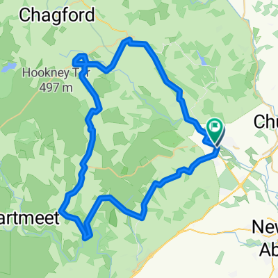
Moretonhampstead-Lakes
- 24.9 km
- 465 m
- 465 m
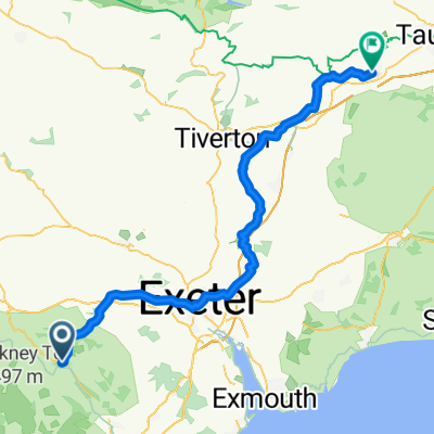
- Bovey Tracey, England, United Kingdom
DARTMOOR 2
A cycling route starting in Bovey Tracey, England, United Kingdom.
Overview
created this 7 years ago
Part of
DARTMOOR 2
1 stage
Route quality
Quiet road
6.1 km
(11 %)
Road
1.7 km
(3 %)
Paved
37 km
(67 %)
Unpaved
0.6 km
(1 %)
Asphalt
33.7 km
(61 %)
Paved (undefined)
3.3 km
(6 %)
Continue with Bikemap
You would like to ride POSSIBLE 2ND DARTMOOR (START BOVEY TRACEY) or customize it for your own trip? Here is what you can do with this Bikemap route:
Free trial for 3 days, or one-time payment. More about Bikemap Premium.
Discover more Premium features.
Get Bikemap PremiumFrom our community
Open it in the app