

Holtwick-Ahsen-Runde
A cycling route starting in Oer-Erkenschwick, North Rhine-Westphalia, Germany.
Overview
About this route
Speed-Trekking Circuit Those who just want to ride on asphalt can use the parallel road between Bossendorf and Ahsen instead of the Canalweg. Those who want to see the remnants of the witch beeches should leave the route and continue on the K42 further north. At the stone marked 'Hexenbuchen' on the right, then 200m of woodland path.
- -:--
- Duration
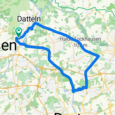
- 46.4 km
- Distance
- 187 m
- Ascent
- 182 m
- Descent
- ---
- Avg. speed
- 120 m
- Max. altitude
Route quality
Waytypes & surfaces along the route
Waytypes
Path
13 km
(28 %)
Quiet road
11.1 km
(24 %)
Surfaces
Paved
28.3 km
(61 %)
Unpaved
7.4 km
(16 %)
Asphalt
28.3 km
(61 %)
Gravel
7.4 km
(16 %)
Undefined
10.7 km
(23 %)
Route highlights
Points of interest along the route

Point of interest after 21.1 km
Hexenbuchen
Continue with Bikemap
Use, edit, or download this cycling route
You would like to ride Holtwick-Ahsen-Runde or customize it for your own trip? Here is what you can do with this Bikemap route:
Free features
- Save this route as favorite or in collections
- Copy & plan your own version of this route
- Sync your route with Garmin or Wahoo
Premium features
Free trial for 3 days, or one-time payment. More about Bikemap Premium.
- Navigate this route on iOS & Android
- Export a GPX / KML file of this route
- Create your custom printout (try it for free)
- Download this route for offline navigation
Discover more Premium features.
Get Bikemap PremiumFrom our community
Other popular routes starting in Oer-Erkenschwick
 Haard
Haard- Distance
- 17 km
- Ascent
- 171 m
- Descent
- 171 m
- Location
- Oer-Erkenschwick, North Rhine-Westphalia, Germany
 Marl-Sinsen
- Distance
- 64.6 km
- Ascent
- 480 m
- Descent
- 477 m
- Location
- Oer-Erkenschwick, North Rhine-Westphalia, Germany
 Haardtour
- Distance
- 31.5 km
- Ascent
- 90 m
- Descent
- 97 m
- Location
- Oer-Erkenschwick, North Rhine-Westphalia, Germany
 Schiffshebewerk-Lüdinghausen
- Distance
- 29.5 km
- Ascent
- 116 m
- Descent
- 74 m
- Location
- Oer-Erkenschwick, North Rhine-Westphalia, Germany
 Holtwick-Ahsen-Runde
- Distance
- 46.4 km
- Ascent
- 187 m
- Descent
- 182 m
- Location
- Oer-Erkenschwick, North Rhine-Westphalia, Germany
 Datteln - Kökelsumer Hofcafe
- Distance
- 32 km
- Ascent
- 78 m
- Descent
- 76 m
- Location
- Oer-Erkenschwick, North Rhine-Westphalia, Germany
 Kanaltour + Grävingholz
- Distance
- 37.8 km
- Ascent
- 92 m
- Descent
- 92 m
- Location
- Oer-Erkenschwick, North Rhine-Westphalia, Germany
 Hohe-Mark-Runde
- Distance
- 71.8 km
- Ascent
- 316 m
- Descent
- 321 m
- Location
- Oer-Erkenschwick, North Rhine-Westphalia, Germany
Open it in the app