

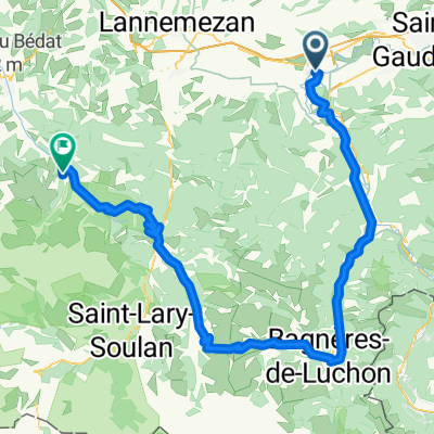
PYR The Road to Artigue
A cycling route starting in Gourdan-Polignan, Occitanie, France.
Overview
About this route
Ned Col de Mente
Trolig noe grus
- -:--
- Duration
- 53.1 km
- Distance
- 1,121 m
- Ascent
- 1,123 m
- Descent
- ---
- Avg. speed
- ---
- Max. altitude

Route quality
Waytypes & surfaces along the route
Waytypes
Quiet road
13.8 km
(26 %)
Road
7.4 km
(14 %)
Surfaces
Paved
27.1 km
(51 %)
Unpaved
6.4 km
(12 %)
Asphalt
27.1 km
(51 %)
Gravel
6.4 km
(12 %)
Undefined
19.7 km
(37 %)
Continue with Bikemap
Use, edit, or download this cycling route
You would like to ride PYR The Road to Artigue or customize it for your own trip? Here is what you can do with this Bikemap route:
Free features
- Save this route as favorite or in collections
- Copy & plan your own version of this route
- Sync your route with Garmin or Wahoo
Premium features
Free trial for 3 days, or one-time payment. More about Bikemap Premium.
- Navigate this route on iOS & Android
- Export a GPX / KML file of this route
- Create your custom printout (try it for free)
- Download this route for offline navigation
Discover more Premium features.
Get Bikemap PremiumFrom our community
Other popular routes starting in Gourdan-Polignan
 2 Saint Bertrand Comminges - Lourdes
- Distance
- 63.6 km
- Ascent
- 785 m
- Descent
- 838 m
- Location
- Gourdan-Polignan, Occitanie, France
 Mauleon-Barousse - Arreau
- Distance
- 83.2 km
- Ascent
- 2,574 m
- Descent
- 2,435 m
- Location
- Gourdan-Polignan, Occitanie, France
 FR Montréjeau - Über Peyresourde und Aspin nach Campan
- Distance
- 99.1 km
- Ascent
- 2,110 m
- Descent
- 1,636 m
- Location
- Gourdan-Polignan, Occitanie, France
 Stage 7 - Cent Cols
- Distance
- 181.7 km
- Ascent
- 2,440 m
- Descent
- 2,574 m
- Location
- Gourdan-Polignan, Occitanie, France
 Loures-Barousse - Port de Boucharo
- Distance
- 182.1 km
- Ascent
- 5,830 m
- Descent
- 4,004 m
- Location
- Gourdan-Polignan, Occitanie, France
 Bertren, Port de Bales, Col de Peyresourde loop
- Distance
- 117.5 km
- Ascent
- 2,173 m
- Descent
- 2,173 m
- Location
- Gourdan-Polignan, Occitanie, France
 1-Barbazan-Bales-Bagneres-Barbazan
- Distance
- 89.8 km
- Ascent
- 1,488 m
- Descent
- 1,487 m
- Location
- Gourdan-Polignan, Occitanie, France
 PYR The Road to Artigue
- Distance
- 53.1 km
- Ascent
- 1,121 m
- Descent
- 1,123 m
- Location
- Gourdan-Polignan, Occitanie, France
Open it in the app