

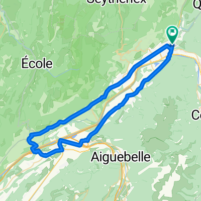
2018-06-15 / Col des Cyclotouristes + Col du Joly
A cycling route starting in Albertville, Auvergne-Rhône-Alpes, France.
Overview
About this route
- -:--
- Duration
- 97.2 km
- Distance
- 2,445 m
- Ascent
- 2,446 m
- Descent
- ---
- Avg. speed
- ---
- Max. altitude

Route quality
Waytypes & surfaces along the route
Waytypes
Quiet road
41.8 km
(43 %)
Road
32.1 km
(33 %)
Surfaces
Paved
50.6 km
(52 %)
Asphalt
50.6 km
(52 %)
Undefined
46.7 km
(48 %)
Route highlights
Points of interest along the route

Point of interest after 12.3 km
Col des Cyclotouristes - 1305 m

Point of interest after 55.1 km
Col du Joly - 1989 m
Continue with Bikemap
Use, edit, or download this cycling route
You would like to ride 2018-06-15 / Col des Cyclotouristes + Col du Joly or customize it for your own trip? Here is what you can do with this Bikemap route:
Free features
- Save this route as favorite or in collections
- Copy & plan your own version of this route
- Split it into stages to create a multi-day tour
- Sync your route with Garmin or Wahoo
Premium features
Free trial for 3 days, or one-time payment. More about Bikemap Premium.
- Navigate this route on iOS & Android
- Export a GPX / KML file of this route
- Create your custom printout (try it for free)
- Download this route for offline navigation
Discover more Premium features.
Get Bikemap PremiumFrom our community
Other popular routes starting in Albertville
 2018-06-16 / Col de Montessuit + Col du Pré + Cormet de Roselend + Lac de la Gittaz
- Distance
- 88.4 km
- Ascent
- 2,021 m
- Descent
- 2,020 m
- Location
- Albertville, Auvergne-Rhône-Alpes, France
 Albertville, Col de l'Arpettaz, Albertville.
- Distance
- 60.6 km
- Ascent
- 1,285 m
- Descent
- 1,285 m
- Location
- Albertville, Auvergne-Rhône-Alpes, France
 marthod1
- Distance
- 17.9 km
- Ascent
- 912 m
- Descent
- 31 m
- Location
- Albertville, Auvergne-Rhône-Alpes, France
 Rhone-Alpes: Etappe 2
- Distance
- 75.1 km
- Ascent
- 1,903 m
- Descent
- 1,673 m
- Location
- Albertville, Auvergne-Rhône-Alpes, France
 Cormet de Roselend
- Distance
- 77.9 km
- Ascent
- 2,870 m
- Descent
- 2,390 m
- Location
- Albertville, Auvergne-Rhône-Alpes, France
 La Combe de Savoie // Albertville - St Pierre d'Albigny
- Distance
- 54.4 km
- Ascent
- 435 m
- Descent
- 435 m
- Location
- Albertville, Auvergne-Rhône-Alpes, France
 Beaufortain
- Distance
- 106.1 km
- Ascent
- 2,940 m
- Descent
- 2,941 m
- Location
- Albertville, Auvergne-Rhône-Alpes, France
 20.07 IX etapp Albertville - Saint-Jean-de-Maurienne
- Distance
- 81.2 km
- Ascent
- 1,975 m
- Descent
- 1,860 m
- Location
- Albertville, Auvergne-Rhône-Alpes, France
Open it in the app