

Gersche Sommertour (rund um Gera)
A cycling route starting in Gera, Thuringia, Germany.
Overview
About this route
Alt-Bieblach-Berliner street -Heinrichstraße/Arcaden-Reichstraße -Pforten-Zwötzen-Salzstraße Elsterradweg-Meilitz-Elsterradweg Wünschen dorf-Ronneburger street-Towards Pohlen-Wind turbines-Zwickauer street_niebra-Liebschwitz-Roundabout-Zoitzberg street-Vogtland street-On the Elster-Elster bridge Zwötzen-Elsterradweg-Stadium am Steg-Omega-Behind the South Railway Station-Baumarkt-Heinrichs bridge-Playground-Karl-Marx-Allee-Peace street _Vollersdorfer street-Heinrichsgrün-Textima bridge-Hofwiesenpark-Untermhäuser Bridge-At Gries-Cubabridge -Schaffwiesen settlement-City railway bridge-Esel bridge -Altbieblach
- -:--
- Duration
- 40.5 km
- Distance
- 276 m
- Ascent
- 278 m
- Descent
- ---
- Avg. speed
- ---
- Max. altitude

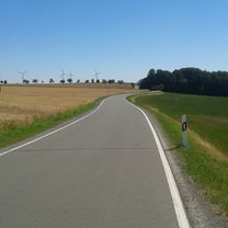
Route photos
\"")
Route quality
Waytypes & surfaces along the route
Waytypes
Path
9.3 km
(23 %)
Quiet road
8.9 km
(22 %)
Surfaces
Paved
25.5 km
(63 %)
Unpaved
0.8 km
(2 %)
Asphalt
25.1 km
(62 %)
Ground
0.8 km
(2 %)
Continue with Bikemap
Use, edit, or download this cycling route
You would like to ride Gersche Sommertour (rund um Gera) or customize it for your own trip? Here is what you can do with this Bikemap route:
Free features
- Save this route as favorite or in collections
- Copy & plan your own version of this route
- Sync your route with Garmin or Wahoo
Premium features
Free trial for 3 days, or one-time payment. More about Bikemap Premium.
- Navigate this route on iOS & Android
- Export a GPX / KML file of this route
- Create your custom printout (try it for free)
- Download this route for offline navigation
Discover more Premium features.
Get Bikemap PremiumFrom our community
Other popular routes starting in Gera
 Crimmitschau - Kap Arkona 2013 R 01/T01/TA02/V01
- Distance
- 29 km
- Ascent
- 171 m
- Descent
- 205 m
- Location
- Gera, Thuringia, Germany
 Mühltalrunde etwas größer
- Distance
- 50.8 km
- Ascent
- 318 m
- Descent
- 318 m
- Location
- Gera, Thuringia, Germany
 Mühltal bei Eisenberg
- Distance
- 51 km
- Ascent
- 278 m
- Descent
- 278 m
- Location
- Gera, Thuringia, Germany
 Gersche Sommertour (rund um Gera)
- Distance
- 40.5 km
- Ascent
- 276 m
- Descent
- 278 m
- Location
- Gera, Thuringia, Germany
 Gera-Wünschendorf-Gera 16.3.2015
- Distance
- 35.6 km
- Ascent
- 187 m
- Descent
- 187 m
- Location
- Gera, Thuringia, Germany
 RBT Gera-Jena
- Distance
- 45.8 km
- Ascent
- 345 m
- Descent
- 414 m
- Location
- Gera, Thuringia, Germany
 Gera Süd Runde MTB
- Distance
- 64 km
- Ascent
- 855 m
- Descent
- 860 m
- Location
- Gera, Thuringia, Germany
 Gera Pegau
- Distance
- 46.9 km
- Ascent
- 143 m
- Descent
- 201 m
- Location
- Gera, Thuringia, Germany
Open it in the app