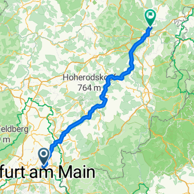
Hohe Straße
A cycling route starting in Maintal, Hesse, Germany.
Overview
About this route
Die Hohe Straße ist einfach wunderbar zu befahren und landschaftlich sehr reizvoll
- -:--
- Duration
- 47.4 km
- Distance
- 223 m
- Ascent
- 229 m
- Descent
- ---
- Avg. speed
- 212 m
- Avg. speed
Route quality
Waytypes & surfaces along the route
Waytypes
Track
15.3 km
(32 %)
Busy road
7.4 km
(16 %)
Surfaces
Paved
44 km
(93 %)
Unpaved
2.2 km
(5 %)
Asphalt
39.8 km
(84 %)
Concrete
3.6 km
(8 %)
Continue with Bikemap
Use, edit, or download this cycling route
You would like to ride Hohe Straße or customize it for your own trip? Here is what you can do with this Bikemap route:
Free features
- Save this route as favorite or in collections
- Copy & plan your own version of this route
- Sync your route with Garmin or Wahoo
Premium features
Free trial for 3 days, or one-time payment. More about Bikemap Premium.
- Navigate this route on iOS & Android
- Export a GPX / KML file of this route
- Create your custom printout (try it for free)
- Download this route for offline navigation
Discover more Premium features.
Get Bikemap PremiumFrom our community
Other popular routes starting in Maintal
- PW T1 Maintal - Buchberg
- Distance
- 44.7 km
- Ascent
- 130 m
- Descent
- 130 m
- Location
- Maintal, Hesse, Germany
- Bergen-Bischofsheim-Riederwald
- Distance
- 23.8 km
- Ascent
- 114 m
- Descent
- 114 m
- Location
- Maintal, Hesse, Germany
- PW Maintal Seligenstadt Albstadt Hanau Maintal
- Distance
- 62.1 km
- Ascent
- 337 m
- Descent
- 332 m
- Location
- Maintal, Hesse, Germany
- Rumpenheim-Hahnenkamm-Alzenau
- Distance
- 35.3 km
- Ascent
- 146 m
- Descent
- 44 m
- Location
- Maintal, Hesse, Germany
- Hohe Straße
- Distance
- 47.4 km
- Ascent
- 223 m
- Descent
- 229 m
- Location
- Maintal, Hesse, Germany
- Taunusstraße 2F, Maintal nach Taunusstraße 2F, Maintal
- Distance
- 15.4 km
- Ascent
- 143 m
- Descent
- 142 m
- Location
- Maintal, Hesse, Germany
- Rundkurs Wachenbuchen-Wilhelmsbad-Bruchköbel-Marköbel-Wachenbuchen
- Distance
- 37.8 km
- Ascent
- 179 m
- Descent
- 135 m
- Location
- Maintal, Hesse, Germany
- Rundweg Wachenbuchen-Nidda-Hohe Str.-Wachenbuchen
- Distance
- 30.9 km
- Ascent
- 221 m
- Descent
- 169 m
- Location
- Maintal, Hesse, Germany
Open it in the app