

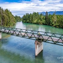
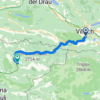
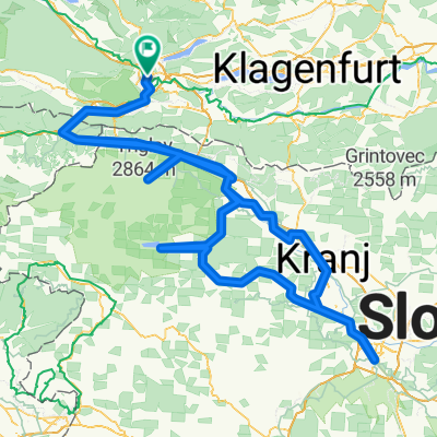
Villach Gardasee
A cycling route starting in Villach, Carinthia, Austria.
Overview
About this route
- -:--
- Duration
- 376.1 km
- Distance
- 798 m
- Ascent
- 1,174 m
- Descent
- ---
- Avg. speed
- ---
- Max. altitude

Route quality
Waytypes & surfaces along the route
Waytypes
Cycleway
191.8 km
(51 %)
Quiet road
60.2 km
(16 %)
Surfaces
Paved
312.2 km
(83 %)
Unpaved
37.6 km
(10 %)
Asphalt
297.2 km
(79 %)
Paved (undefined)
15 km
(4 %)
Continue with Bikemap
Use, edit, or download this cycling route
You would like to ride Villach Gardasee or customize it for your own trip? Here is what you can do with this Bikemap route:
Free features
- Save this route as favorite or in collections
- Copy & plan your own version of this route
- Split it into stages to create a multi-day tour
- Sync your route with Garmin or Wahoo
Premium features
Free trial for 3 days, or one-time payment. More about Bikemap Premium.
- Navigate this route on iOS & Android
- Export a GPX / KML file of this route
- Create your custom printout (try it for free)
- Download this route for offline navigation
Discover more Premium features.
Get Bikemap PremiumFrom our community
Other popular routes starting in Villach
 Carinthian Lake Loop - Villach to Villach
- Distance
- 438.5 km
- Ascent
- 3,948 m
- Descent
- 3,948 m
- Location
- Villach, Carinthia, Austria
 Karawankenweg - Via Roma
- Distance
- 70.4 km
- Ascent
- 1,223 m
- Descent
- 1,365 m
- Location
- Villach, Carinthia, Austria
 D1_Feldkirchen to Seeboden
- Distance
- 81.6 km
- Ascent
- 1,056 m
- Descent
- 988 m
- Location
- Villach, Carinthia, Austria
 Alpenpässe Ö-Slo_I
- Distance
- 133.9 km
- Ascent
- 2,620 m
- Descent
- 2,620 m
- Location
- Villach, Carinthia, Austria
 Draupromenade, Villach nach Standesamtsplatz, Villach
- Distance
- 204.4 km
- Ascent
- 3,175 m
- Descent
- 3,161 m
- Location
- Villach, Carinthia, Austria
 Leiningengasse to Umfahrungsstraße
- Distance
- 94.4 km
- Ascent
- 784 m
- Descent
- 862 m
- Location
- Villach, Carinthia, Austria
 Kärntner Seenrunde Fritz u, Walter Mai 2025
- Distance
- 371.9 km
- Ascent
- 4,439 m
- Descent
- 4,438 m
- Location
- Villach, Carinthia, Austria
 Route to Villach Central Station
- Distance
- 366.7 km
- Ascent
- 7,863 m
- Descent
- 7,864 m
- Location
- Villach, Carinthia, Austria
Open it in the app