

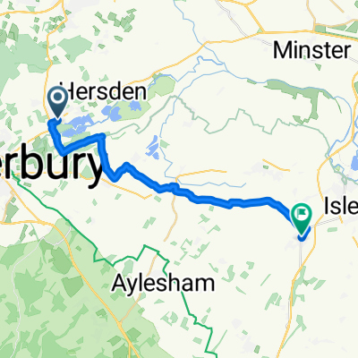
Canterbury-Paris
A cycling route starting in Sturry, England, United Kingdom.
Overview
About this route
- -:--
- Duration
- 357.3 km
- Distance
- 910 m
- Ascent
- 908 m
- Descent
- ---
- Avg. speed
- ---
- Max. altitude

Route quality
Waytypes & surfaces along the route
Waytypes
Road
141.1 km
(39 %)
Busy road
82.8 km
(23 %)
Surfaces
Paved
138.6 km
(39 %)
Unpaved
7.5 km
(2 %)
Asphalt
130.7 km
(37 %)
Paved (undefined)
4.2 km
(1 %)
Continue with Bikemap
Use, edit, or download this cycling route
You would like to ride Canterbury-Paris or customize it for your own trip? Here is what you can do with this Bikemap route:
Free features
- Save this route as favorite or in collections
- Copy & plan your own version of this route
- Split it into stages to create a multi-day tour
- Sync your route with Garmin or Wahoo
Premium features
Free trial for 3 days, or one-time payment. More about Bikemap Premium.
- Navigate this route on iOS & Android
- Export a GPX / KML file of this route
- Create your custom printout (try it for free)
- Download this route for offline navigation
Discover more Premium features.
Get Bikemap PremiumFrom our community
Other popular routes starting in Sturry
 Race to Thieval UK Side
- Distance
- 48.1 km
- Ascent
- 209 m
- Descent
- 204 m
- Location
- Sturry, England, United Kingdom
 76 Shalloak Road, Canterbury to 78 Shalloak Road, Canterbury
- Distance
- 30.5 km
- Ascent
- 79 m
- Descent
- 132 m
- Location
- Sturry, England, United Kingdom
 78 Shalloak Road, Canterbury to 78 Shalloak Road, Canterbury
- Distance
- 36 km
- Ascent
- 78 m
- Descent
- 127 m
- Location
- Sturry, England, United Kingdom
 76 Island Road, Canterbury to Vine Cottage, Sandwich Road, Sandwich
- Distance
- 19.7 km
- Ascent
- 3 m
- Descent
- 15 m
- Location
- Sturry, England, United Kingdom
 Moderate route in Canterbury
- Distance
- 16.2 km
- Ascent
- 121 m
- Descent
- 100 m
- Location
- Sturry, England, United Kingdom
 The Paddle House, Grove Ferry, Canterbury to The Paddle House, Grove Ferry, Canterbury
- Distance
- 16.6 km
- Ascent
- 10 m
- Descent
- 10 m
- Location
- Sturry, England, United Kingdom
 Canterbury-Paris
- Distance
- 357.3 km
- Ascent
- 910 m
- Descent
- 908 m
- Location
- Sturry, England, United Kingdom
 6 Ickham Court Farm, The Street, Canterbury to 135 Island Wall, Whitstable
- Distance
- 23.9 km
- Ascent
- 226 m
- Descent
- 236 m
- Location
- Sturry, England, United Kingdom
Open it in the app