

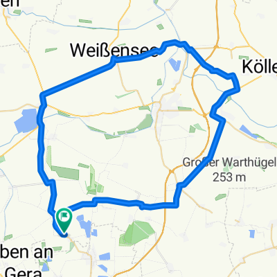
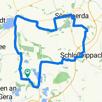
Nöda Apolda
A cycling route starting in Nöda, Thuringia, Germany.
Overview
About this route
- -:--
- Duration
- 48.3 km
- Distance
- 351 m
- Ascent
- 319 m
- Descent
- ---
- Avg. speed
- ---
- Max. altitude
Evil Cadence
created this 16 years ago
Route quality
Waytypes & surfaces along the route
Waytypes
Road
14 km
29 %
Track
8.7 km
18 %
Surfaces
Paved
40.1 km
(83 %)
Unpaved
2.9 km
(6 %)
Asphalt
36.7 km
76 %
Ground
2.4 km
5 %
Route highlights
Points of interest along the route
Point of interest after 48 km
Point of interest after 48 km
Continue with Bikemap
Use, edit, or download this cycling route
You would like to ride Nöda Apolda or customize it for your own trip? Here is what you can do with this Bikemap route:
Free features
- Save this route as favorite or in collections
- Copy & plan your own version of this route
- Sync your route with Garmin or Wahoo
Premium features
Free trial for 3 days, or one-time payment. More about Bikemap Premium.
- Navigate this route on iOS & Android
- Export a GPX / KML file of this route
- Create your custom printout (try it for free)
- Download this route for offline navigation
Discover more Premium features.
Get Bikemap PremiumFrom our community
Other popular routes starting in Nöda
- Nöda Bienstedt
- 52.6 km
- 341 m
- 344 m
- Nöda, Thuringia, Germany
- Rund um SÖM
- 55.4 km
- 181 m
- 181 m
- Nöda, Thuringia, Germany
- Nöda Apolda
- 48.3 km
- 351 m
- 319 m
- Nöda, Thuringia, Germany
- Nöda-Friemar-Craula-Bad Tennstedt-Nöda
- 129.4 km
- 482 m
- 485 m
- Nöda, Thuringia, Germany
- Nöda Greußen Sprötau
- 90.1 km
- 313 m
- 313 m
- Nöda, Thuringia, Germany


Open it in the app