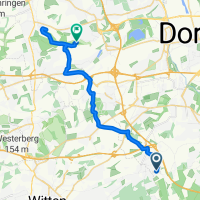
Auf dem Rheinischen Esel
A cycling route starting in Witten, North Rhine-Westphalia, Germany.
Overview
About this route
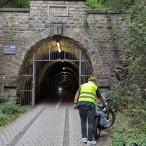
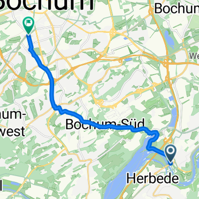
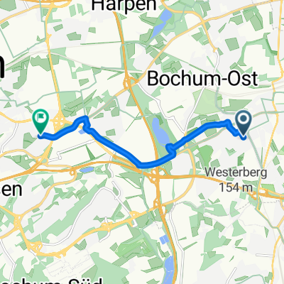
Von BO-Langendreer nach WIT-Annen, Kruckel, Hombruch usw. durch das östliche Ruhrgebiet. Und das ohne nennenswerte Steigungen, weil überwiegend unterwegs auf ehem. Bahntrassen.
- -:--
- Duration
- 43.3 km
- Distance
- 200 m
- Ascent
- 198 m
- Descent
- ---
- Avg. speed
- ---
- Max. altitude
Route quality
Waytypes & surfaces along the route
Waytypes
Path
19 km
(44 %)
Quiet road
16 km
(37 %)
Surfaces
Paved
31.6 km
(73 %)
Unpaved
9.1 km
(21 %)
Asphalt
31.2 km
(72 %)
Gravel
5.6 km
(13 %)
Continue with Bikemap
Use, edit, or download this cycling route
You would like to ride Auf dem Rheinischen Esel or customize it for your own trip? Here is what you can do with this Bikemap route:
Free features
- Save this route as favorite or in collections
- Copy & plan your own version of this route
- Sync your route with Garmin or Wahoo
Premium features
Free trial for 3 days, or one-time payment. More about Bikemap Premium.
- Navigate this route on iOS & Android
- Export a GPX / KML file of this route
- Create your custom printout (try it for free)
- Download this route for offline navigation
Discover more Premium features.
Get Bikemap PremiumFrom our community
Other popular routes starting in Witten
- ketteimmerrechts.de // kir-ig.de
- Distance
- 49.7 km
- Ascent
- 455 m
- Descent
- 458 m
- Location
- Witten, North Rhine-Westphalia, Germany
- Mountainbike 1
- Distance
- 32.1 km
- Ascent
- 232 m
- Descent
- 230 m
- Location
- Witten, North Rhine-Westphalia, Germany
- 18.10.2008 Matal Motion Bike Freunde Herbede
- Distance
- 38.2 km
- Ascent
- 363 m
- Descent
- 360 m
- Location
- Witten, North Rhine-Westphalia, Germany
- Kleine Ruhrrunde
- Distance
- 52.5 km
- Ascent
- 350 m
- Descent
- 362 m
- Location
- Witten, North Rhine-Westphalia, Germany
- Do-Oespel - Sprockhövel - Do-Oespel
- Distance
- 45.7 km
- Ascent
- 344 m
- Descent
- 344 m
- Location
- Witten, North Rhine-Westphalia, Germany
- Rundkurs ums Autobahnkreuz Do-West
- Distance
- 19.9 km
- Ascent
- 93 m
- Descent
- 94 m
- Location
- Witten, North Rhine-Westphalia, Germany
- Wittentrails
- Distance
- 18.5 km
- Ascent
- 329 m
- Descent
- 329 m
- Location
- Witten, North Rhine-Westphalia, Germany
- Lahmen Hasen V3
- Distance
- 109.4 km
- Ascent
- 842 m
- Descent
- 841 m
- Location
- Witten, North Rhine-Westphalia, Germany
Open it in the app