

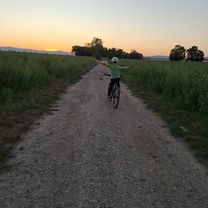
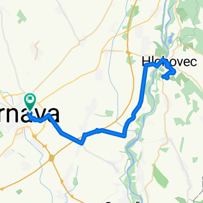
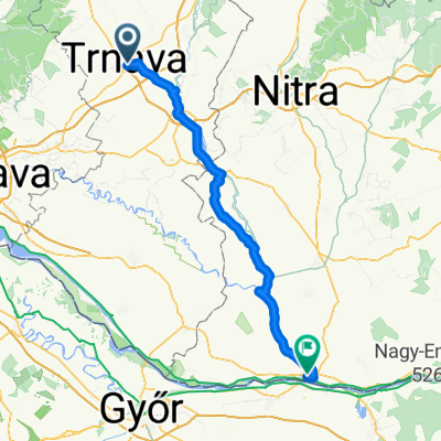
Trnava - Dobrá Voda - Dechtice
A cycling route starting in Trnava, Trnava Region, Slovakia.
Overview
About this route
Asfalt - cesty, polne / lesne cesty
- -:--
- Duration
- 69.1 km
- Distance
- 503 m
- Ascent
- 502 m
- Descent
- ---
- Avg. speed
- 404 m
- Max. altitude

Route quality
Waytypes & surfaces along the route
Waytypes
Road
35.2 km
(51 %)
Track
10.4 km
(15 %)
Surfaces
Paved
58.7 km
(85 %)
Unpaved
4.8 km
(7 %)
Asphalt
58.7 km
(85 %)
Gravel
4.8 km
(7 %)
Undefined
5.5 km
(8 %)
Continue with Bikemap
Use, edit, or download this cycling route
You would like to ride Trnava - Dobrá Voda - Dechtice or customize it for your own trip? Here is what you can do with this Bikemap route:
Free features
- Save this route as favorite or in collections
- Copy & plan your own version of this route
- Sync your route with Garmin or Wahoo
Premium features
Free trial for 3 days, or one-time payment. More about Bikemap Premium.
- Navigate this route on iOS & Android
- Export a GPX / KML file of this route
- Create your custom printout (try it for free)
- Download this route for offline navigation
Discover more Premium features.
Get Bikemap PremiumFrom our community
Other popular routes starting in Trnava
 Farská púť 2018
- Distance
- 247.1 km
- Ascent
- 549 m
- Descent
- 540 m
- Location
- Trnava, Trnava Region, Slovakia
 Trnavská do M. R. Štefánika
- Distance
- 11.5 km
- Ascent
- 15 m
- Descent
- 60 m
- Location
- Trnava, Trnava Region, Slovakia
 M. R. Štefánika do M. R. Štefánika
- Distance
- 10 km
- Ascent
- 18 m
- Descent
- 65 m
- Location
- Trnava, Trnava Region, Slovakia
 Vladimíra Clementisa, Trnava až Vladimíra Clementisa, Trnava
- Distance
- 55.9 km
- Ascent
- 226 m
- Descent
- 223 m
- Location
- Trnava, Trnava Region, Slovakia
 Biely Kostal
- Distance
- 11.3 km
- Ascent
- 20 m
- Descent
- 17 m
- Location
- Trnava, Trnava Region, Slovakia
 Školská, Šúrovce až Školská, Šúrovce
- Distance
- 58.2 km
- Ascent
- 279 m
- Descent
- 279 m
- Location
- Trnava, Trnava Region, Slovakia
 Tyrnau - Komárom
- Distance
- 99.5 km
- Ascent
- 128 m
- Descent
- 159 m
- Location
- Trnava, Trnava Region, Slovakia
 Opojský malý okruh
- Distance
- 19.3 km
- Ascent
- 41 m
- Descent
- 40 m
- Location
- Trnava, Trnava Region, Slovakia
Open it in the app