

Lake Oswego - Portland Loop
A cycling route starting in Lake Oswego, Oregon, United States.
Overview
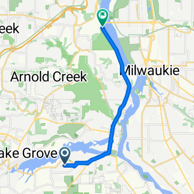
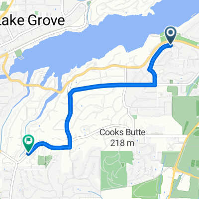
About this route
A loop designed with medium high intensity that travels through some of the southern suburbs of portland. The route is designd to start at Lakeridge high school and also end there. The Portland Saturday Market is the Midpoint where the cyclist(s) should take a long break and eat lunch. Stops have been marked along the way as points of intrest.
*Note this route is only to be taken on Saturdays as the midpoint of the trip is the Portland Saturday Market
- -:--
- Duration
- 46.7 km
- Distance
- 470 m
- Ascent
- 470 m
- Descent
- ---
- Avg. speed
- ---
- Max. altitude

Route quality
Waytypes & surfaces along the route
Waytypes
Path
14.5 km
(31 %)
Road
9.8 km
(21 %)
Surfaces
Paved
31.8 km
(68 %)
Asphalt
15.9 km
(34 %)
Paved (undefined)
11.2 km
(24 %)
Route highlights
Points of interest along the route
Point of interest after 27 km
Portland Saturday Market stop for Lunch
Point of interest after 42.4 km
Ice Cream Stop
Continue with Bikemap
Use, edit, or download this cycling route
You would like to ride Lake Oswego - Portland Loop or customize it for your own trip? Here is what you can do with this Bikemap route:
Free features
- Save this route as favorite or in collections
- Copy & plan your own version of this route
- Sync your route with Garmin or Wahoo
Premium features
Free trial for 3 days, or one-time payment. More about Bikemap Premium.
- Navigate this route on iOS & Android
- Export a GPX / KML file of this route
- Create your custom printout (try it for free)
- Download this route for offline navigation
Discover more Premium features.
Get Bikemap PremiumFrom our community
Other popular routes starting in Lake Oswego
 SW Palatine St, Portland to SE Rio Vista St, Milwaukie
- Distance
- 11.6 km
- Ascent
- 238 m
- Descent
- 259 m
- Location
- Lake Oswego, Oregon, United States
 Work to Home (Old River Rd-Pimlico-Miles)
- Distance
- 8.9 km
- Ascent
- 241 m
- Descent
- 95 m
- Location
- Lake Oswego, Oregon, United States
 First Ride - 4mi
- Distance
- 15.5 km
- Ascent
- 200 m
- Descent
- 200 m
- Location
- Lake Oswego, Oregon, United States
 Lake Oswego/Canby
- Distance
- 94.1 km
- Ascent
- 619 m
- Descent
- 629 m
- Location
- Lake Oswego, Oregon, United States
 Lake Oswego & Portland Waterfront
- Distance
- 46.5 km
- Ascent
- 433 m
- Descent
- 433 m
- Location
- Lake Oswego, Oregon, United States
 to Sellwood Bridge
- Distance
- 9 km
- Ascent
- 93 m
- Descent
- 197 m
- Location
- Lake Oswego, Oregon, United States
 to Royce and Bryant
- Distance
- 3.5 km
- Ascent
- 39 m
- Descent
- 140 m
- Location
- Lake Oswego, Oregon, United States
 Tryon Cr. Cedar to Old Main to Red Fox
- Distance
- 5.1 km
- Ascent
- 124 m
- Descent
- 125 m
- Location
- Lake Oswego, Oregon, United States
Open it in the app