

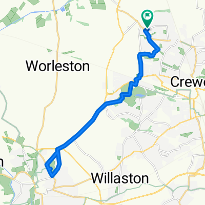
Windermere Ride
A cycling route starting in Crewe, England, United Kingdom.
Overview
About this route
- -:--
- Duration
- 266.7 km
- Distance
- 403 m
- Ascent
- 405 m
- Descent
- ---
- Avg. speed
- ---
- Max. altitude

Continue with Bikemap
Use, edit, or download this cycling route
You would like to ride Windermere Ride or customize it for your own trip? Here is what you can do with this Bikemap route:
Free features
- Save this route as favorite or in collections
- Copy & plan your own version of this route
- Split it into stages to create a multi-day tour
- Sync your route with Garmin or Wahoo
Premium features
Free trial for 3 days, or one-time payment. More about Bikemap Premium.
- Navigate this route on iOS & Android
- Export a GPX / KML file of this route
- Create your custom printout (try it for free)
- Download this route for offline navigation
Discover more Premium features.
Get Bikemap PremiumFrom our community
Other popular routes starting in Crewe
 1st try
- Distance
- 244.5 km
- Ascent
- 1,931 m
- Descent
- 1,923 m
- Location
- Crewe, England, United Kingdom
 101k Three Counties Sportive - Crewe
- Distance
- 101.8 km
- Ascent
- 388 m
- Descent
- 389 m
- Location
- Crewe, England, United Kingdom
 Windermere Ride
- Distance
- 266.7 km
- Ascent
- 403 m
- Descent
- 405 m
- Location
- Crewe, England, United Kingdom
 z- 100 Climbs No 35 Curbar Edge Max 16% - 100 mile route
- Distance
- 158.7 km
- Ascent
- 1,224 m
- Descent
- 1,224 m
- Location
- Crewe, England, United Kingdom
 Cymru North Coast - DAY 1.zz
- Distance
- 46.5 km
- Ascent
- 136 m
- Descent
- 158 m
- Location
- Crewe, England, United Kingdom
 Run Out
- Distance
- 38.9 km
- Ascent
- 86 m
- Descent
- 87 m
- Location
- Crewe, England, United Kingdom
 Horseshoe Pass
- Distance
- 139 km
- Ascent
- 719 m
- Descent
- 718 m
- Location
- Crewe, England, United Kingdom
 Becconsall Drive, Crewe to Becconsall Drive, Crewe
- Distance
- 16.9 km
- Ascent
- 52 m
- Descent
- 53 m
- Location
- Crewe, England, United Kingdom
Open it in the app