

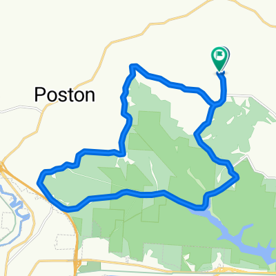
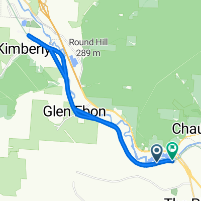
Bailey's Loop
A cycling route starting in Chauncey, Ohio, United States of America.
Overview
About this route
A mostly unpaved (according to my map printed in 2015) loop around the Bailey's Tract of Wayne National Forest. I plan to ride it for real later this week or next week
- -:--
- Duration
- 21.5 km
- Distance
- 181 m
- Ascent
- 181 m
- Descent
- ---
- Avg. speed
- ---
- Avg. speed

Route quality
Waytypes & surfaces along the route
Waytypes
Quiet road
19.3 km
(90 %)
Busy road
2.3 km
(10 %)
Undefined
-0 km
(<1 %)
Surfaces
Paved
0.2 km
(1 %)
Unpaved
8.9 km
(41 %)
Gravel
8.9 km
(41 %)
Asphalt
0.2 km
(1 %)
Undefined
12.4 km
(58 %)
Continue with Bikemap
Use, edit, or download this cycling route
You would like to ride Bailey's Loop or customize it for your own trip? Here is what you can do with this Bikemap route:
Free features
- Save this route as favorite or in collections
- Copy & plan your own version of this route
- Sync your route with Garmin or Wahoo
Premium features
Free trial for 3 days, or one-time payment. More about Bikemap Premium.
- Navigate this route on iOS & Android
- Export a GPX / KML file of this route
- Create your custom printout (try it for free)
- Download this route for offline navigation
Discover more Premium features.
Get Bikemap PremiumFrom our community
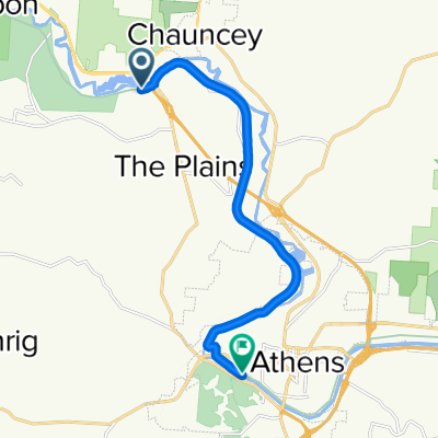
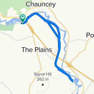
Other popular routes starting in Chauncey
 TAGC22 50M - Coal Run Start - Alternative - TAGC22 50M - Coal Run Start - Alternative
- Distance
- 73.9 km
- Ascent
- 1,608 m
- Descent
- 1,620 m
- Location
- Chauncey, Ohio, United States of America
 Testroute
- Distance
- 20 km
- Ascent
- 245 m
- Descent
- 249 m
- Location
- Chauncey, Ohio, United States of America
 Bailey's Loop
- Distance
- 21.5 km
- Ascent
- 181 m
- Descent
- 181 m
- Location
- Chauncey, Ohio, United States of America
 7980 Lemaster Rd, Athens to 7980 Lemaster Rd, Athens
- Distance
- 5.7 km
- Ascent
- 83 m
- Descent
- 95 m
- Location
- Chauncey, Ohio, United States of America
 Hockhocking Adena Bikeway, Athens to 7980 Lemaster Rd, Athens
- Distance
- 17.3 km
- Ascent
- 67 m
- Descent
- 63 m
- Location
- Chauncey, Ohio, United States of America
 Recovered Route
- Distance
- 11.7 km
- Ascent
- 0 m
- Descent
- 6 m
- Location
- Chauncey, Ohio, United States of America
 7980 Lemaster Rd, Athens to 6680–6686 Hamley Run Rd, Athens
- Distance
- 14.2 km
- Ascent
- 250 m
- Descent
- 251 m
- Location
- Chauncey, Ohio, United States of America
Open it in the app