Chatillon la Palud-Pont de Chéruy tranquille
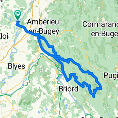
A cycling route starting in Châtillon-la-Palud, Auvergne-Rhône-Alpes, France.
Overview
About this route
Mon trajet boulot, pas grand monde dessus.
- -:--
- Duration
- 29.5 km
- Distance
- 71 m
- Ascent
- 171 m
- Descent
- ---
- Avg. speed
- ---
- Avg. speed
Route quality
Waytypes & surfaces along the route
Waytypes
Quiet road
10 km
(34 %)
Busy road
9 km
(30 %)
Surfaces
Paved
7.9 km
(27 %)
Unpaved
1.2 km
(4 %)
Asphalt
7.9 km
(27 %)
Gravel
1.2 km
(4 %)
Undefined
20.4 km
(69 %)
Continue with Bikemap
Use, edit, or download this cycling route
You would like to ride Chatillon la Palud-Pont de Chéruy tranquille or customize it for your own trip? Here is what you can do with this Bikemap route:
Free features
- Save this route as favorite or in collections
- Copy & plan your own version of this route
- Sync your route with Garmin or Wahoo
Premium features
Free trial for 3 days, or one-time payment. More about Bikemap Premium.
- Navigate this route on iOS & Android
- Export a GPX / KML file of this route
- Create your custom printout (try it for free)
- Download this route for offline navigation
Discover more Premium features.
Get Bikemap PremiumFrom our community
Other popular routes starting in Châtillon-la-Palud
- Pont-d'ain Lac
- Distance
- 81.7 km
- Ascent
- 493 m
- Descent
- 223 m
- Location
- Châtillon-la-Palud, Auvergne-Rhône-Alpes, France
- Chatillon la Palud - Lac de Paladru
- Distance
- 87.3 km
- Ascent
- 506 m
- Descent
- 318 m
- Location
- Châtillon-la-Palud, Auvergne-Rhône-Alpes, France
- Restful route in Rignieux-le-Franc
- Distance
- 4 km
- Ascent
- 16 m
- Descent
- 31 m
- Location
- Châtillon-la-Palud, Auvergne-Rhône-Alpes, France
- Chatillon la Palud - lac Palud Charavines
- Distance
- 84.5 km
- Ascent
- 537 m
- Descent
- 347 m
- Location
- Châtillon-la-Palud, Auvergne-Rhône-Alpes, France
- Chatillon la Palud-Pont de Chéruy tranquille
- Distance
- 29.5 km
- Ascent
- 71 m
- Descent
- 171 m
- Location
- Châtillon-la-Palud, Auvergne-Rhône-Alpes, France
- Entrainement 2
- Distance
- 67 km
- Ascent
- 454 m
- Descent
- 454 m
- Location
- Châtillon-la-Palud, Auvergne-Rhône-Alpes, France
- 69–255 Route de Pont-d'Ain, Châtillon-la-Palud à 57 Place de l'Église, Saint-Maurice-de-Rémens
- Distance
- 4.4 km
- Ascent
- 22 m
- Descent
- 22 m
- Location
- Châtillon-la-Palud, Auvergne-Rhône-Alpes, France
- The lake district
- Distance
- 121.9 km
- Ascent
- 334 m
- Descent
- 339 m
- Location
- Châtillon-la-Palud, Auvergne-Rhône-Alpes, France
Open it in the app