

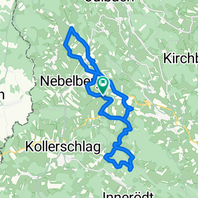
Tschechien Teil 2a
A cycling route starting in Nebelberg, Upper Austria, Austria.
Overview
About this route
- -:--
- Duration
- 70.4 km
- Distance
- 829 m
- Ascent
- 928 m
- Descent
- ---
- Avg. speed
- ---
- Max. altitude

Route quality
Waytypes & surfaces along the route
Waytypes
Road
27.5 km
(39 %)
Quiet road
23.2 km
(33 %)
Surfaces
Paved
15.5 km
(22 %)
Unpaved
9.9 km
(14 %)
Asphalt
15.5 km
(22 %)
Gravel
7 km
(10 %)
Continue with Bikemap
Use, edit, or download this cycling route
You would like to ride Tschechien Teil 2a or customize it for your own trip? Here is what you can do with this Bikemap route:
Free features
- Save this route as favorite or in collections
- Copy & plan your own version of this route
- Sync your route with Garmin or Wahoo
Premium features
Free trial for 3 days, or one-time payment. More about Bikemap Premium.
- Navigate this route on iOS & Android
- Export a GPX / KML file of this route
- Create your custom printout (try it for free)
- Download this route for offline navigation
Discover more Premium features.
Get Bikemap PremiumFrom our community
Other popular routes starting in Nebelberg
 Vnb - Rinnmühle - Unterthiergrub - Kriegwald - hoam
- Distance
- 29.7 km
- Ascent
- 814 m
- Descent
- 812 m
- Location
- Nebelberg, Upper Austria, Austria
 Druckerfranzlstein-Runde
- Distance
- 18.6 km
- Ascent
- 371 m
- Descent
- 367 m
- Location
- Nebelberg, Upper Austria, Austria
 Haselbachrunde erweitert
- Distance
- 34.9 km
- Ascent
- 877 m
- Descent
- 871 m
- Location
- Nebelberg, Upper Austria, Austria
 Fitnessrunde; Lengau-Haselbach-Blutwurzhütte-Kohlstatt
- Distance
- 44.1 km
- Ascent
- 587 m
- Descent
- 575 m
- Location
- Nebelberg, Upper Austria, Austria
 Tschechien Teil 2a
- Distance
- 70.4 km
- Ascent
- 829 m
- Descent
- 928 m
- Location
- Nebelberg, Upper Austria, Austria
 Oaglatsedt - BW-Hütte
- Distance
- 44.5 km
- Ascent
- 1,045 m
- Descent
- 1,040 m
- Location
- Nebelberg, Upper Austria, Austria
 Nusssteig 15 bis Nusssteig 15
- Distance
- 39.5 km
- Ascent
- 924 m
- Descent
- 924 m
- Location
- Nebelberg, Upper Austria, Austria
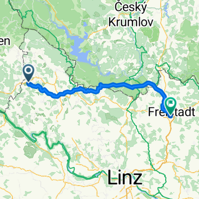 Kollerschlag nach Freistadt
- Distance
- 72 km
- Ascent
- 1,817 m
- Descent
- 1,995 m
- Location
- Nebelberg, Upper Austria, Austria
Open it in the app