

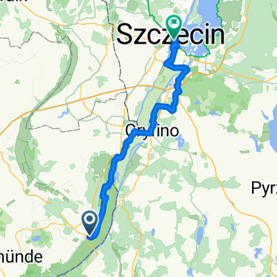
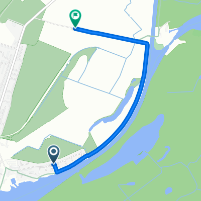
schwedt-stettin
A cycling route starting in Schwedt, Brandenburg, Germany.
Overview
About this route
- -:--
- Duration
- 58.3 km
- Distance
- 198 m
- Ascent
- 174 m
- Descent
- ---
- Avg. speed
- ---
- Max. altitude

Continue with Bikemap
Use, edit, or download this cycling route
You would like to ride schwedt-stettin or customize it for your own trip? Here is what you can do with this Bikemap route:
Free features
- Save this route as favorite or in collections
- Copy & plan your own version of this route
- Sync your route with Garmin or Wahoo
Premium features
Free trial for 3 days, or one-time payment. More about Bikemap Premium.
- Navigate this route on iOS & Android
- Export a GPX / KML file of this route
- Create your custom printout (try it for free)
- Download this route for offline navigation
Discover more Premium features.
Get Bikemap PremiumFrom our community
Other popular routes starting in Schwedt
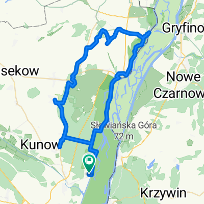
 Schwedt - Kunow - Gatow (16.06.2024)
- Distance
- 30.9 km
- Ascent
- 63 m
- Descent
- 64 m
- Location
- Schwedt, Brandenburg, Germany
 schwedt-stettin
- Distance
- 58.3 km
- Ascent
- 198 m
- Descent
- 174 m
- Location
- Schwedt, Brandenburg, Germany
 Heinersdorfer Damm - nach Bahnhofstraße
- Distance
- 66.5 km
- Ascent
- 240 m
- Descent
- 233 m
- Location
- Schwedt, Brandenburg, Germany
 D 06 66km Schwedt-Stettin
- Distance
- 65.9 km
- Ascent
- 253 m
- Descent
- 250 m
- Location
- Schwedt, Brandenburg, Germany
 Sonntagsrunde
- Distance
- 35.6 km
- Ascent
- 182 m
- Descent
- 198 m
- Location
- Schwedt, Brandenburg, Germany
 Sonntagssport
- Distance
- 38.3 km
- Ascent
- 48 m
- Descent
- 56 m
- Location
- Schwedt, Brandenburg, Germany
 Route nach Berlin
- Distance
- 2.9 km
- Ascent
- 3 m
- Descent
- 7 m
- Location
- Schwedt, Brandenburg, Germany
 Landwiesenweg nach Zum Teerofen
- Distance
- 57 km
- Ascent
- 279 m
- Descent
- 278 m
- Location
- Schwedt, Brandenburg, Germany
Open it in the app