

Sergy-Grignan
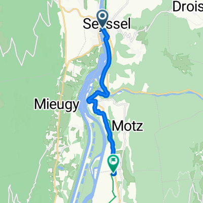
Motz- Charavines etape 2
A cycling route starting in Versonnex, Auvergne-Rhône-Alpes, France.
Overview
About this route
- -:--
- Duration
- 81.9 km
- Distance
- 427 m
- Ascent
- 376 m
- Descent
- ---
- Avg. speed
- ---
- Max. altitude

Part of
Sergy-Grignan
5 stages
Route quality
Waytypes & surfaces along the route
Waytypes
Quiet road
25.4 km
(31 %)
Cycleway
22.9 km
(28 %)
Surfaces
Paved
51.6 km
(63 %)
Asphalt
51.6 km
(63 %)
Undefined
30.3 km
(37 %)
Continue with Bikemap
Use, edit, or download this cycling route
You would like to ride Motz- Charavines etape 2 or customize it for your own trip? Here is what you can do with this Bikemap route:
Free features
- Save this route as favorite or in collections
- Copy & plan your own version of this route
- Split it into stages to create a multi-day tour
- Sync your route with Garmin or Wahoo
Premium features
Free trial for 3 days, or one-time payment. More about Bikemap Premium.
- Navigate this route on iOS & Android
- Export a GPX / KML file of this route
- Create your custom printout (try it for free)
- Download this route for offline navigation
Discover more Premium features.
Get Bikemap PremiumFrom our community
Other popular routes starting in Versonnex
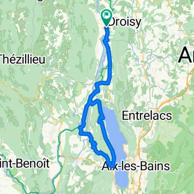
 étape 3 jours 1
- Distance
- 35.2 km
- Ascent
- 214 m
- Descent
- 235 m
- Location
- Versonnex, Auvergne-Rhône-Alpes, France
 Genf-Lyon 2. Etappe
- Distance
- 69.4 km
- Ascent
- 403 m
- Descent
- 430 m
- Location
- Versonnex, Auvergne-Rhône-Alpes, France
 J-2: Back sur la Via Rhona
- Distance
- 83 km
- Ascent
- 149 m
- Descent
- 198 m
- Location
- Versonnex, Auvergne-Rhône-Alpes, France
 8 Quai du Rhône, Seyssel to 155 Rue Stéphane Duc, Serrières-en-Chautagne
- Distance
- 8.2 km
- Ascent
- 97 m
- Descent
- 90 m
- Location
- Versonnex, Auvergne-Rhône-Alpes, France
 Le Tour du Chat
- Distance
- 85.1 km
- Ascent
- 608 m
- Descent
- 610 m
- Location
- Versonnex, Auvergne-Rhône-Alpes, France
 ViaRhona-2
- Distance
- 81 km
- Ascent
- 394 m
- Descent
- 410 m
- Location
- Versonnex, Auvergne-Rhône-Alpes, France
 VR08 Seyssel-Champagneux.kml - VR08 Seyssel-Champagneux.kml_VR08 Seyssel-Champagneux
- Distance
- 54 km
- Ascent
- 262 m
- Descent
- 311 m
- Location
- Versonnex, Auvergne-Rhône-Alpes, France
 Juracross Einfahren
- Distance
- 61.4 km
- Ascent
- 1,358 m
- Descent
- 1,386 m
- Location
- Versonnex, Auvergne-Rhône-Alpes, France
Open it in the app