

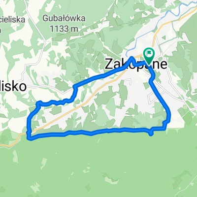
D03ZaNoSa
A cycling route starting in Zakopane, Lesser Poland Voivodeship, Poland.
Overview
About this route
mimo jezera, + Lesena cerkev in grad ob jezeru
- -:--
- Duration
- 100.1 km
- Distance
- 256 m
- Ascent
- 820 m
- Descent
- ---
- Avg. speed
- ---
- Max. altitude

Route quality
Waytypes & surfaces along the route
Waytypes
Road
25 km
(25 %)
Quiet road
19 km
(19 %)
Surfaces
Paved
81.1 km
(81 %)
Unpaved
4 km
(4 %)
Asphalt
81.1 km
(81 %)
Ground
3 km
(3 %)
Route highlights
Points of interest along the route
Accommodation after 0 km
H02HotelPRL
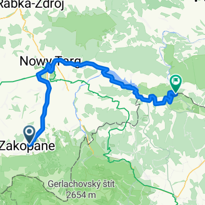
Point of interest after 45.8 km
D03GradCzorsztyn
Continue with Bikemap
Use, edit, or download this cycling route
You would like to ride D03ZaNoSa or customize it for your own trip? Here is what you can do with this Bikemap route:
Free features
- Save this route as favorite or in collections
- Copy & plan your own version of this route
- Split it into stages to create a multi-day tour
- Sync your route with Garmin or Wahoo
Premium features
Free trial for 3 days, or one-time payment. More about Bikemap Premium.
- Navigate this route on iOS & Android
- Export a GPX / KML file of this route
- Create your custom printout (try it for free)
- Download this route for offline navigation
Discover more Premium features.
Get Bikemap PremiumFrom our community
Other popular routes starting in Zakopane
 szlak 2
- Distance
- 12.7 km
- Ascent
- 366 m
- Descent
- 406 m
- Location
- Zakopane, Lesser Poland Voivodeship, Poland
 VeloDunajec (z objazdami brakujących odcinków)
- Distance
- 82.8 km
- Ascent
- 889 m
- Descent
- 1,282 m
- Location
- Zakopane, Lesser Poland Voivodeship, Poland
 Day 2 Easier option
- Distance
- 15.5 km
- Ascent
- 661 m
- Descent
- 664 m
- Location
- Zakopane, Lesser Poland Voivodeship, Poland
 Masa Krytyczna - Pierwsza na Podhalu!
- Distance
- 13.8 km
- Ascent
- 191 m
- Descent
- 191 m
- Location
- Zakopane, Lesser Poland Voivodeship, Poland
 49.222, 19.962 až 49.144, 19.903
- Distance
- 12.3 km
- Ascent
- 44 m
- Descent
- 441 m
- Location
- Zakopane, Lesser Poland Voivodeship, Poland
 Zakopane - Wierch Poroniec - Głodówka - Bukowina - Zakopane
- Distance
- 36.3 km
- Ascent
- 563 m
- Descent
- 563 m
- Location
- Zakopane, Lesser Poland Voivodeship, Poland
 Guty 3b, Zakopane do Trzech Koron 34a, Sromowce Niżne
- Distance
- 81.8 km
- Ascent
- 1,945 m
- Descent
- 2,262 m
- Location
- Zakopane, Lesser Poland Voivodeship, Poland
 D03v1ZaNoSa
- Distance
- 92.1 km
- Ascent
- 336 m
- Descent
- 900 m
- Location
- Zakopane, Lesser Poland Voivodeship, Poland
Open it in the app