

Haldi Bike
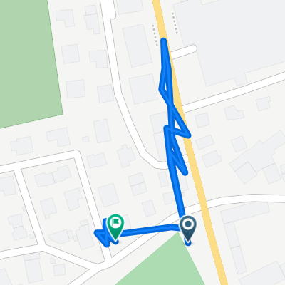
A cycling route starting in Schattdorf, Canton of Uri, Switzerland.
Overview
About this route
Die Bikeroute führt Sie auf das Haldi, die Sonnenterasse oberhalb von Schattdorf. Die abwechslungsreiche Tour führt über
Waldstrassen, Alpwege und Singletrail vorbei am Billentrog, einem mythischen Ort der Kraft mit besonderer Ausstrahlung.
Den Aufstieg auf das Haldi fahren Sie über die stetig ansteigende, meistens im Schatten liegende Waldstrasse. Beim Heimwesen
Figstuel bietet sich eine erste Möglichkeit, die traumhafte Aussicht bis zum Urnersee zu geniessen. Weiter führt Sie der Weg
entlang von saftigen Blumenwiesen aufs Oberfeld, mit 1446 m der höchste Punkt Ihrer Tour. Eingesäumt durch die umliegenden
Berge ist eine kurze Rast angezeigt, bevor Sie den attraktiven Singletrail via Billenwald unter die Räder nehmen. Über
attraktives Weidegebiet führt Sie der Weg vorbei am Billentrog, dem Ort der Kraft: Trinken Sie einen Schluck des Wassers und
geniessen Sie für einen kurzen Moment die Stille. Beim Schwandiberg empfiehlt sich ein 3 km langer Abstecher zum
Aussichtspunkt Schilt. Der Aufstieg ist anspruchsvoll, doch Sie werden mit einer fantastischen Aussicht über den ganzen Urner
Talboden belohnt. Jetzt haben Sie eine Portion Älplermagronen verdient. Dies ist eine Spezialität des Restaurant Alpenrösli,
direkt neben der Haldikapelle, welche an eine norwegische Stabskirche erinnert. Als Abschluss geniessen Sie die eindrucksvolle
Abfahrt durch prachtvollen Laubwald entlang dem alten Waldweg nach Schattdorf.
- -:--
- Duration
- 24.7 km
- Distance
- 1,243 m
- Ascent
- 1,312 m
- Descent
- ---
- Avg. speed
- ---
- Avg. speed

Route quality
Waytypes & surfaces along the route
Waytypes
Track
18.4 km
(75 %)
Quiet road
6.3 km
(25 %)
Undefined
-0 km
(<1 %)
Surfaces
Paved
6.3 km
(25 %)
Unpaved
18.4 km
(75 %)
Gravel
14.4 km
(58 %)
Asphalt
6.3 km
(25 %)
Continue with Bikemap
Use, edit, or download this cycling route
You would like to ride Haldi Bike or customize it for your own trip? Here is what you can do with this Bikemap route:
Free features
- Save this route as favorite or in collections
- Copy & plan your own version of this route
- Sync your route with Garmin or Wahoo
Premium features
Free trial for 3 days, or one-time payment. More about Bikemap Premium.
- Navigate this route on iOS & Android
- Export a GPX / KML file of this route
- Create your custom printout (try it for free)
- Download this route for offline navigation
Discover more Premium features.
Get Bikemap PremiumFrom our community
Other popular routes starting in Schattdorf
 Gitschental
- Distance
- 26.4 km
- Ascent
- 1,098 m
- Descent
- 1,100 m
- Location
- Schattdorf, Canton of Uri, Switzerland
 Haldi Bike
- Distance
- 24.7 km
- Ascent
- 1,243 m
- Descent
- 1,312 m
- Location
- Schattdorf, Canton of Uri, Switzerland
 Haldi
Haldi- Distance
- 11.4 km
- Ascent
- 826 m
- Descent
- 710 m
- Location
- Schattdorf, Canton of Uri, Switzerland
 Bärchi Isenthal
- Distance
- 32.8 km
- Ascent
- 945 m
- Descent
- 964 m
- Location
- Schattdorf, Canton of Uri, Switzerland
 schattdorf - Bristen - Golzern Seilbahn
- Distance
- 17.9 km
- Ascent
- 247 m
- Descent
- 101 m
- Location
- Schattdorf, Canton of Uri, Switzerland
 Kurze Ausfahrt von Schattdorf nach Bürglen (UR)
- Distance
- 0.5 km
- Ascent
- 0 m
- Descent
- 0 m
- Location
- Schattdorf, Canton of Uri, Switzerland
 TT_U-E03
- Distance
- 62.6 km
- Ascent
- 2,105 m
- Descent
- 1,390 m
- Location
- Schattdorf, Canton of Uri, Switzerland
 spiss-waldi climb
- Distance
- 9.1 km
- Ascent
- 689 m
- Descent
- 137 m
- Location
- Schattdorf, Canton of Uri, Switzerland
Open it in the app